Wednesday, October 13, 2010

Cotton Bottom Inn: Holladay


Day 1: Wasatch from Back to Front

In 1909, Julius Kuck looked out from his Willow Patch cabin in Big Cottonwood over a canyon filled with hundreds of mining claims, ore buckets being hauled up the steep sides of quartzite cliffs by clanking wooden gears, the townships of Argenta and Brighton boasting saloons and hotels, multiple hydro-electric plants churning away, at least 6 mills and waves of hikers that had recently taken it into their heads that the mountain wasn’t just for natural resources any more, and said, “Hermiting ain’t what it used to be.” If Kuck bemoaned the loss of his solitude in the turn of the century Wasatch, what chance do I have of finding any today?

The parking lot at the Little/Big Water trailhead is full to bursting. The overflow lot is full. The over over flow lot is full. Cars are illegally parked anywhere there is space. More cars make their way up and down the canyon, looking for parking and picnic spots. Hikers and dog walkers and cyclists pour down the single track, tree-lined road, narrowly avoiding falling into the creek when more hikers and dog walkers and cyclists arrive in their loaded down 4-Runners and Honda Civics. Dads hauling coolers and crates dart out from behind bushes, causing cars to swerve. Once summer-sleek trees, bushes and flowers take their seasonal cue to tumble into the road, battling the hikers, dog walkers and cyclists for space.

An SUV pulls up beside me; a carefully matched, overly-coifed, blonde and very white family spills out, adjusting their black and beige, straight off the rack at Nordstrom clothes, passing bowtied-babies back and forth. Soon, the now rumple-free family is poised and posed for their family picture. Hovering in the middle of a browning meadow, backed with golden aspens, the adults speak in goobery voices and make gooney faces at the babies. The babies respond by squalling. Adam’s jaw works as he shoulders his pack. I rush to put on my boots so that we can get the hell out of here.
                                          
Hiking fast, we cross Millcreek and head up the Old Red Pine Road, retreating into country that sees a little less traffic. Soon, all we can hear is water and an occasional gust of wind. For the next few miles, aspens grow thick and golden. Conifers ooze sticky pungent sap. The occasional cyclist buzzes down the old jeep road and we walk.

Our plan is to spend the next two and a half days hiking the Desolation Trail. Over the thirteen years I have lived in Salt Lake, I have hiked small, disconnected sections of the trail, but have never seen it all, start to finish. This has left me with a rather disjointed impression of the Wasatch. An impression that is marked by hikers talking on their cell phones. A Wasatch of discreet segments—little worlds cordoned off by clearly marked trails and signs and by use. This is the section used for rock climbing. This is the section used for downhill cycling. This is the picnic section. The ski section. This is where couples go on first date hikes. I have begun to feel that the world of the Wasatch is overrun. Like there is no wildness left here. I would like to be convinced otherwise. To feel that my world is not so limited.

The first day of hiking then, ends up feeling like a gift. After leaving the still familiar concourse of the Mill Creek/Great Western Trail, we cross an unmaintained historic trail and find ourselves in a valley that feels empty. Stepping out from a dense copse of aspen caught in the middle of transforming from Summer to Fall, green to gold, a meadow of tall wheat colored grasses spreads out before us. It feels as though this basin hasn’t seen action since the pioneers built a mill here in the 1870s. Its gently rising sides are covered in aspens to the east and conifers to the west. The bowl shaped valley is easily over a mile and a half long and half a mile across, rising gradually in elevation to meet the back wall; a ridge that we will follow to re-intersect the Great Western. The trail we are following is visible, but only just; probably kept open by bow hunters. The amount of open space here feels luxurious. We see no foot prints in the dirt.


We descend to Desolation Lake—and the start of the Desolation Trail—in near darkness. In this subdued light, aspen trunks appear as simple lines. After a fat dinner of mashed potatoes, gravy, green beans from the farmers’ market, and backpacker steak (pre-cooked beef meatballs that were packed in frozen and allowed to thaw as we hiked), we snuggle down to spend a night burning off all those calories trying to keep warm. I sleep fabulously, better than I did in my own bed last night. I listen. No one is here but us.


Day 2: Trail Runners, Adam’s Ass and Other Curiosities

Trail runners are a breed I am almost entirely unfamiliar with. Their habits, customs of dress, all make no sense to me. Waking up in total darkness to the sound of pounding feet, I lie for a while listening, watching through the nylon of my tent as little headlamp lights bounce past. Then the singing starts, “Oh…oh,oh,oh…oh…mnamnamna…yah, yaaaahhh…ohohoh” all the way down, 200 vertical feet from ridge top to lake shore. It’s sometime before 6 am. That means these people have been running since at least 5:30. They left the warmth of their beds, put on their silly little shorts, and are running through a pristine, utterly silent landscape in the dark, listening to their ipods. These people are crazy.

Then there is a lull. By the time the 8 am crowd rolls through, Adam and I are sitting up in our tent eating bagels and cream cheese. A throng of at least 13 hikers joins the fray, making me glad that our camp is tucked behind a rocky outcropping. They laugh and tease each other, talking loudly, seeming to forget that here they don’t have to fight to be heard. Several more trail runners pass. Then a crowd of cyclists. After the last group, it grows quiet again and I crawl out of my tent to really look around. As I do, the sun comes up over the ridge to the east and illuminates the aspen stand surrounding us. The sky is so blue it stings. The leaves are suffused with bright yellow light. All around me the trees and the sky and the bushes are full with such an intensity of color; you couldn’t possibly inject anymore into them. Fruits ready to burst with juice. I of course, start to cry. I am a champion crier.

During the mid-morning lull, the one before all of the families with small children and Friday night partiers descend on Dog Lake (our next destination), we pack up. Just as we do, our quiet is cut through by the hack hack of a private helicopter tour out to see the colors. Incensed, Adam responds to this violent disruption of our first peaceful moment since waking in classic Adam fashion: he presents them with his bare backside. He dances around our camp, bare ass bobbing, taunting our areal tourists and singing a slanderous song, apparently for his own gratification since they obviously can’t hear him. The offenders respond by circling our camp one more time.

Before taking off for what will be a 7 mile day following the Desolation trail to Mill A Basin, we wander around Desolation Lake for a while. There is no record of how Desolation Lake, Desolation Peak, and other numerous Desolations scattered around Utah got their names. I don’t know, but I’m going to assume it’s biblical. The abomination of desolation and all that. The land of desolation, etc…. I can imagine that to pioneers coming from the much more lush east coast, and perhaps from the greens of Scotland, England and Ireland, this area did look pretty desolate. I do know that this lake is one of the few in the Wasatch that Mormon settlers, the CCC and the Forest Service haven’t messed with. Most of the rest—Lake Blanche, Lake Mary, the Twin Lakes—have been either created from basically nothing or amplified through damming. The lake is also a sump; a body of water with no outlet. It sits here, high up in this glacial bowl, an aquamarine jewel, set in an utterly bare red shore studded by a few sharp edged, black boulders. Since the area is watershed, swimming is strictly forbidden. If it were 10 degrees warmer, I would have to do it anyway. My standing as an otherwise law abiding citizen is safe another day.

Our trail takes us past Dog Lake—named by settlers in 1870 for the salamanders (or dog fish) swimming in its thick, murky, totally unappealing, depths and not, surprisingly, for the dozen odd dogs that seem to be a permanent fixture here—along the Millcreek/Big Cottonwood ridge until we enter the Mt Olympus Wilderness Area and quiet. Late in the afternoon, hotter than we thought we would be and consequently more thirsty, we approach Mill A Basin located just below Baker Pass. Since most hikers leave the Desolation trail here to climb Gobblers Knob, we hope to camp just a little further along, at the base of Mt Raymond. Turning the corner that brings our potential camp into view, we see a pillar of smoke. Below it, a bright orange tent blazes against a dark green juniper. Damn.

At this point I am a little dehydrated because it has been a while since we pumped water and I’m running low. In my exhaustion, I couldn’t care less where we camp and I’m having a hard time making a decision on a new place. Mill A doesn’t have any significant water, but Adam came across a spring here once while exploring the area a few years ago—a pipe coming right out of the hillside—and is hoping to find it again. After wandering a bit, we come across a historic trail, now abandoned, follow it into a hanging meadow and collapse in a field primarily inhabited by ground squirrels; every few steps our feet sink down into the dirt, caving in one of their innumerable tunnels.

As soon as we clear a big enough space on the ground for our tent, Adam heads off looking for the spring. Thirty minutes later he’s back. He can’t find it. He’s tired. It’s time to take stock. We have enough water to get through the night if we just eat sandwiches for dinner (instead of cooking the dehydrated beans, chicken, avocadoes, etc we had originally planned on), but in the morning we will need water right away. We have a few options. Adam could go looking for the spring again. He could hike up to Baker spring—1.4 miles and some serious elevation gain out of our way—fill up, then come back and meet me here so that we can continue along the Desolation Trail. Or we can both hike to Baker Spring, abandon our plans to hike the Deso Trail, and descend Alexander Basin, leaving us with a few miles of road hiking before we reach the car. We play a half game of cribbage and go to bed.

Day 3: Water

In the morning, we’ve just decided to hike to Baker Spring, ditching our original goal, when Adam sees a curiously inscripted aspen just south of our camp. He wanders off. I barely pay attention until he comes back carrying 3 litre bottles of water with Sam’s Club labels neatly intact. “There’s a cache over there,” he motions. I follow him to the aspen, the treasure map; “Buz 2004” and an arrow pointing south. Just behind a good sized log, a slightly molded and chewed up tarp covers a pit with 4 bottles of water and a metal grate wrapped in cellophane. Adam seems lighter. His relief is obvious. I worry, what about Buz? What if he comes back assuming his water is here? Adam shrugs, “If Buz is even in the state any more, I’d be surprised.” He’s right. It’s been 6 years. Buz probably hopped a train to California ages ago. Leaving with our water bladders at least a little more full, I pause and say a little prayer of thanks to Buz.


The next section of trail is the one that when planning the trip, I was most anxious to see. It’s the section that I knew I would never make it to on a day hike. Even though it’s the furthest west we’ve been, and therefore the closest to the city, it’s the most remote, the least accessed. We leave Mill A for Maxfield Basin, at least not really a basin from where we are so much as a steeply graded, nearly all sluffed off, excuse for a trail, dropping into a basin hundreds of feet below. As I traverse the massively eroded hill side, my pack throwing my balance off, holding my breath at the airyness of the trail, I reach for bushes to stabilize myself only to find too late that they are thorny rose bushes. I only have to panic for a minute. After 50 yards or so, the hillside turns, gentles, the trail widens, though not by much.


The trail for the rest of the day remains patchy, overgrown here and there, frequently passing across shale rock slides. We circumambulate Mount Raymond, following the Desolation to the top of Porter Fork where we leave Big Cottonwood and return to Millcreek. This is where I run out of water. It’s lunch time. We still have over 3 miles to the next water source but most of the remaining trail is north facing and down hill. We don’t worry.

Our descent is littered with the remains of mines, historic trails, cabin debris. As we continue down Porter, Adam points out a claim site where he once found an old cabin, unlocked and entirely intact. It was still thoroughly outfitted, shelves of burlap bags, wool blankets and tin canisters. Adam opened several: canisters and canisters of oatmeal. The mine has since been collapsed by the Forest Service and the cabin is gone, whether by avalanche or man power we don’t know.

It’s still about 2 miles to water when I start to feel the effects of dehydration. I’ve been slurping off Adam’s water but I haven’t wanted to be greedy. It’s much hotter than we anticipated. I get irritable and clumsy. The trail sucks. I have mesh vents in my hiking shoes that are supposed to keep my feet cool but all they’re doing is letting in dirt and sticks which in turn are giving me blisters. It’s 1 more mile to water when we run out.

When planning the trip, Adam suggested that we leave the Desolation trail for the last few miles in favor of descending Thayne Canyon instead. Thayne’s is prettier, taking it would cut 3 miles from what would otherwise be a 10 mile day, and there is supposed to be a spring just below the trail junction where he had watered up before. I decide not to be a purist and take his suggestion. Just after the Thayne/Desolation junction, Adam starts looking around for the spring. It, like the Mill A spring has a pipe coming right out of the ground. When we reach it, it’s high noon and at least 85 degrees. The trough where the spring is supposed to be is shallow and muddy. The pipe lies uselessly on the ground next to the grimy skim of water. There isn’t enough water to submerge our pump into. Adam starts trying to clean out the trough, hoping it will speed the flow and raise the water level. It’s no good. At first he panics and runs up and down the canyon, looking for some other little place where water might surface. There isn’t one. We resignedly shoulder our packs—the only up side to having no water is lighter packs—and quietly head down. It’s been 3 miles since I had a real drink. It’s a couple more to the truck.


The trail down Thayne Canyon cuts through the hill side in a steep sided, rock strewn trough. The walls are covered in red maple and orange and yellow ground cover. The trail is littered with gold aspen leaves. I barely notice. Adam keeps taking off up moist looking spur trails, looking for water. Nothing. My blisters are so bad now, I’m limping badly. When we get within a half mile of the trail head, we encounter our first hikers. I must look as good as I feel because I am getting some stares.

When we get to the truck, Adam remembers that he doesn’t have any water there either, unusual for him, so we have to drive up canyon, through the insane traffic of Sunday afternoon picnicers, a wedding party walking precariously up the road in heels, and what is apparently a family reunion in order to find a quiet place to pump. I’m feeling the strangest sensation; where we have been all day is so different from all of this, it feels like a dream, and all of this is so familiar, it feels like we never went anywhere.

Our original plan was to finish hiking and head to the Cotton Bottom Inn, a bar and grill located at the top of 6200S. Open since at least the 60s, it’s nothing like anything you could possibly imagine finding in this otherwise hoity toity neighborhood. The Porcupine Grill, with its 12$ nachos, doesn’t hold a candle to it for food or ambience. You enter through the kitchen, ducking to avoid low doorways, and come into a wood paneled, loungy, cozy, laid back room of battered mismatched furniture. Bugs bunny is everywhere in one form or another. Most people there are regulars, pool players, and motorcyclists. In the summertime and early fall, the back porch is open, busy and a raging party. They serve fries and grilled ham and cheese and all kinds of stuff but, all anyone goes there for are the garlic burgers. Seriously. These garlic burgers are the definition of garlic burgers, the be all end all, reason to come down the canyon, who cares if you smell bad for a week, fabulisiousist garlic burgers ever. But I am tired. And I don’t want to hang out anywhere but my couch. And my cat is lonely and feeling betrayed, I can feel her intense self-pity, hear her plaintive yowls, from here. So I decide to cheat. In twenty-five minutes I am on my couch, Este pizza on my lap. Trifecta will have to wait for another trip.


A little bit of useful information…

Region: Central/North-Central Utah

Contact Info:
Cotton Bottom Inn
2820 E 6200 S
Holladay, UT 84121
(801) 273-9830

Rating (out of 5) ☼☼☼☼☼:

Burger ☼☼☼☼☼ Fries ☼☼☼ Shake N/A

You May Want to Visit the Cotton Bottom if you are:
Climbing in Little/Big Cottonwood
Camping at the Spruces, Redman, or Albion Basin camp grounds
Skiing or snowboarding in Big/Little Cottonwood
Paragliding off Point of the Mountain or above Ferguson canyon
Bow hunting up Bear Trap canyon
Bird watching in the Wasatch
On a moon light, star gazing, hike away from all the city lights
Escaping inversion
Visiting your ostentatious mountain home…ie your cabin…up the canyon
Searching for faint trails you found in the Rambler (Wasatch Mountain Club)
Hiking the Desolation Trail!


Wednesday, September 15, 2010

Antimony Mercantile: Antimony

Despite the fact that the calendar has just flipped over to September, it is, as Adam says, still very much Summer. We are in the desert. It is Labor day weekend. It’s evening, around 5:30 or so, and it’s still at least 80 degrees. We have just dropped off the east side of Highway 12’s hogback; a narrow, windy, slip of road riding the steep-sided ridge between Calf Creek to the west and Boulder Creek to the east. Although I have traveled this stretch of road literally a hundred times, driving this tiny wedge suspended between dramatic drop-offs still leaves my adrenals stressed and my palms sweaty.


We are tromping across sandy hills covered still, thankfully, joyfully in Sand Verbena (a good name, we think, for a dog), Spiderwort (a flower, not some sort of horrible growth), filmy white patches of Primrose, and Sunflowers. Soon, the sand spreads out across slick rock washes, stone looking as though the water that formed it were still running in rivulets across its surface. The ground is nearly white, occasionally stained gold, rust, or rose. The wash we are following heads down and down, connects with another wash, runs off to the side a little, meanders and then drops off into Boulder Creek.

We move slowly. I am still getting over a three week respiratory infection that had me in bed and then in bed and then in bed a little more. I haven’t carried a pack in a while and I feel laborious and clumsy. Adam skims on ahead of me, sauntering down the slick rock, his walking stick clicking occasionally against juniper roots and sandstone. Adam moves easily, he fairly glides down the steep descent we make to the creek. I have to walk looking at my feet so as not to tumble down the wash. I stop occasionally so that I can look around and remember where I am. I will never move as gracefully through the desert as Adam.


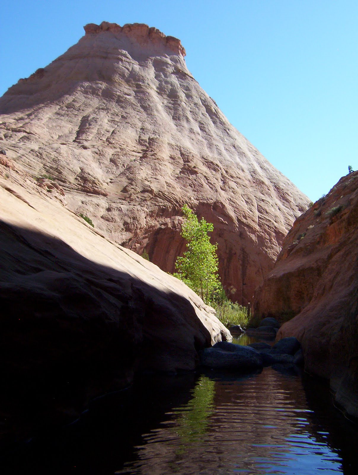
The country around us rises in domes, mesas and turrets, castle battlements made of whitish-gold sandstone. Thirty minutes later we get to the creek bottom, hot, a little irritable and happy for shady Cottonwood trees. This section of Boulder Creek is still relatively close to town—more so than our usual adventure destinations—as evidenced by down-canyon-debris. We pass a big old oil drum, some graffiti etched into the sandstone declaring that “Emily is the Shit,” and a scrunched up green metal gate washed down by a flash flood. It’s obvious that a flash flood of some magnitude tore through here pretty recently. All of the ground cover, water loving willows and tamarisk lay flat, pointing haggardly down stream. It makes walking down canyon alternately a total pain-in-the-ass-thrash and an easy stroll since you can actually see where you are going rather than having to battle through thickets of willows, looking for a trail. Flood debris—bunches of leaves and dirt and bird feathers—rides high in the tops of any tamarisk still standing. A waterline, like a grimy bathtub ring runs close to the canyon walls over even the highest banks. Finding high ground in this flood would have been nearly impossible.


Even as we thrash, Adam and I look at each other every few minutes with wide grins. It’s a thrash and a pain but we are in the desert! It’s been nearly two months since our last trip and the last few weeks have seen us stopping every so often to stare out the window and sigh, longing vocally for a wet canyon and some Cottonwood trees. And here we finally are. As I thrash and trip and stroll, I bring the world down to sounds and smell.
There is very little sound. The pitch of the water riffling down creek shifts slightly depending on whether it’s passing over pebbles, sand, slime, or smooth rock. I can’t hear any birds. I don’t even hear bugs. The air smells awesome. Clean and green and a little mulchy from the flood dregs and that smell particular to rock eroding away under the force of water whether rain or sprinklers or river.

Because we are still relatively high in elevation, we pass the occasional towering Ponderosa; some, burnt out carcasses, lightning struck. Signs of people become more faint. We hike nearly three miles and even though we are headed further down stream tomorrow, decide to camp at what is an exit trail, forming a loop hike that could take you back to the trail head, up on the hogback of Highway 12. This trail too, follows a wash. We scamper up a short wall to a little ridge overlooking the smooth sandy wash bottom. The sand is spotless, not even a bird track. The sky is clear with no forecasted rain. We plop our stuff down right in the middle of the sand and lie out. Our packs are ridiculously heavy for a three—not even full—day trip. This is largely due to the mass quantity of food we brought with us. We are not scrimpers when it comes to food, Adam and I. Adam is a beanpole and we both have blood sugar issues so we need an almost constant stream of calories when hiking. Nuts and other usual backpacking fare won’t cut it however so our food bags are filled with turkey, hard boiled eggs, fresh cucumber from the farmers market, bell pepper...tonight we hover over our cook pot chopping cilantro and green onion to throw into the Pad Thai we are making. A few years ago after I took my whole (almost) family backpacking for the first time, my dad asked my 13 and 15 year old brothers what they had liked best about the trip. They uniformly agreed that the food, not the soaring red walls of Coyote Gulch, not the impressively sized Steven’s Arch, not the pictographs and Anasazi ruins, had made their trip. Nope, it was the miso-ginger-chicken soup I had made the first night out. I guess I’m flattered, but almost anything tastes good when you’re backpacking.


When we lie down to sleep, the crickets are really getting going, pulsing rhythmically into the night. Just above our heads are a series of potholes with slightly stagnant murk crusting over the top. After a few games of Mille Bourne, we turn our headlamps off to flee the gnats and mosquitoes. A few minutes later, without the mesmeric drawing power of the light, the bugs recede and we settle in to a peacefully star-lit night.


The next day we proceed down canyon, stopping at the first real show of entrenched narrows for second breakfast. The canyon is filled with willows and rose bushes that tear at our legs and drive us to criss-cross the stream again and again looking for a clear path. Then, hurray! a smooth rocky sidewalk rises up out of the creek for a stretch, making for delightfully cruisey walking. Just around the corner from where Deer Creek intersects Boulder, we find our exit point and settle in for a lazy and utterly quiet afternoon.

I read. Adam naps and takes short walks up and down the creek, closely examining a patch of thick green moss, some bug larvae, fish hiding beneath the stream banks. I find a deep enough section of creek just below our hangout to take a dip. I watch for birds and look around at the gold walls. I eat a little and wander around barefoot. Adam eats a little and sleeps some more. The afternoon passes. We don’t see another person all day. Just before sundown we hike out, back up onto the golden-white citadels and boulder-strewn mesas above. At the base of the steep pass we need to mount the next day we make camp and look out at the view. Across the creek stretches a slick rock play ground called the Brigham Tea Bench. Between the domes and scalloped tops of the bench lay little green valleys filled with gold flowers and pinion pine. We sit, lean back on our packs and watch the day slowly disappear.


The next morning we are hiking by 6, trying to beat the heat of the sun and get back to the truck by 10. The walk is a constant delight as this is country I have never seen except from the distance of the road and the isolation of my car. Flowers decorate our path, surprising us at every turn. Once back at the truck, we decide to make our way home as slowly as possible, relishing our vacation to the last minute and take the long way to our next destination: The Antimony Mercantile. Stopping briefly at the visitor’s center in Escalante—which is strangely deserted of tourists on what should otherwise be a rowdy weekend—we take off up Main Canyon and over Boulder Mountain. We drive slowly, smelling the Ponderosa scented air and looking at the remains of past forest fires, musing about our time working on the mountain for the Forest Service. As we climb, we pass the corner in the road where I cut through my first really huge tree with an ax. We pass several trail heads we both meant to explore during our seasons on the trail crew. We slow down at Adam’s favorite look-out spot and take in the view: the Straight Cliffs from head to the toe, the entire Circle Cliffs uplift, the Henries, and Mancos Mesa all the way over by Lake Powell.

The Dixie Forest, of which Boulder Mountain is part, is not a grand or dramatic range. But it is gently lovely, littered with any number of meadows—filled now with flowers—and hundreds of little lakes and ponds. Sweet relief when the desert proves too steamy. Coming up over the crest, we run into a cavalcade of ATVs, headed off on a hunting trip. The more volcanic parts of the mountain blend on this side with dramatically red outcroppings that reach full expression further south in Bryce Canyon. Every time we stop to look at a good crumbly hoodoo, peeking up from an otherwise green hillside, a truck full of hunters stops to look, hoping we’ve spotted a buck.

The Main Canyon road we are taking is also sometimes called the Widtsoe road, even though Widtsoe is barely a destination. With 1,100 residents in the late 20’s, the town was once considered as a location for the county seat. Mostly a ghost town now, the township hosts a few mobile homes and one original log cabin. The last time I visited Antimony Merc (17 miles north), there was a man at the bar who told me the classic pioneer tale of growing up in that cabin with his 13 brothers and sisters. He had to be at least 90. We pass Widtsoe as we leave the mountains, entering John’s Valley. Both the names “John” and “Widtsoe” come from John Widtsoe, the president of the University of Utah in 1917, whose expertise in dry farming helped farmers in the area eek out an existence for nearly two decades before finally moving south to the San Juan.

Intersecting Highway 22, we head north and soon drop into Black Canyon, an intimate little gorge with a marshy creek running along the bottom. At times the walls of the canyon loom up grey and bold right next to your car, then spread out eroding into steep rubbely hills cresting hundreds of feet above. The land above is flat as flat. The canyon bottom feels like a hidden world.

In Black Canyon, 12 miles north of Widstoe is another ghost town; Osiris. Well, not really a ghost town as there was only ever one house there—still there and hidden up in the trees—and the remains of an old creamery, perched on the edge of the creek. Every time I pass the creamery, I badly want to explore it. The creamery was built in the twenties, turned into a granary, and abandoned in the 30’s due to drought. The main building is tall and narrow and not at all forbidding considering its isolated location and age. The windows are open and free from glass, making it all the more tempting to crawl right over the sorry-little-fence surrounding the premises, mount the rickety stairs, taking them right to the top.

By the time we reach Antimony we are starving. Antimony is a sort of story book town. The main street is tree lined, enormous old cottonwoods and poplars. Alfalfa fields roll off the road and down into a valley cut through by a number of creeks. Clearly happy cows loll and laze. The few—nearly all historic—houses in town are set back from the road, surrounded by more trees. There is, unfortunately, an abomination of a dude ranch with a huge, plastic, rearing white stallion on the roof of the guest house. And then there is the Antimony Mercantile.


The Antimony Mercantile is a combination grocery store, bait &tackle shop, diner, gas station (with old fashioned pumps), R.V. park and one of my favorite places on earth. It’s not enough that they make their own pie, fresh every day and that their burgers are the definition of slutty goodness, it is the whole package that I love. Inside, the ceiling is low and the shop is jam packed full of stuff. All kinds of stuff. The grill has a bar running long side it and around the corner is the little indoor eating area. The walls surrounding the tables are full, I mean every inch full of pictures of locals with their freshly caught fish, freshly shot elk, slung over the back of their ATVs. There are a few little cubby shelves stuffed with cheap, used paperbacks that you can take, if you leave one in return. There are a few chotchkys, mostly fishing related. Then there is the porch, the best place to sit.

The back porch is littered with picnic tables and metal tables surrounded by mismatched chairs. The roof is made from rough hewn logs and decked with ceiling fans, indoor faux-wood ceiling fans, looking like they’ve been taken from some old dear’s bedroom. There are a few plastic cacti hanging on the wooden back wall of the porch and two outdoor restrooms with “Doe” and “Buck” written on the doors. Next to the porch is a little horse shoe lot, where two guys are playing horse shoes. There is a Jeep parked dangerously close to the end of the lot and each time the men turn to throw that direction, I cringe in disastrous anticipation. The whole back R.V lot is surrounded by tall cottonwoods so that the porch is always shady and cool, even when it’s broiling out.

All summer old folks set up their RV’s, go fishin’ all morning, then spend the afternoon chatting on the porch, drinking coffee and coke from the bottle, and smoking cigarettes. These people now live in Florida but come back here to be with their grandkids and ride ATVs around the mountain. They all know each other. Have for decades. We sit at an old picnic table. Next to us are two couples in their seventies. The men wear impossibly baggy Lee jeans held up by rainbow striped suspenders. The women have on layers of fusia lipstick and hairsprayed hair. One has a little nondescript white dog on her lap which she talks to in baby talk, calling it “baby” and referring to her self as “momma” as she feeds it little bits of burger. The other woman moans pornographically over her burger, exclaiming “oh my!” and “this is soooo good!” through mouthfuls of food. The family to the other side, the one playing hose shoes, jokes and laughs and compares the effectiveness of ATVs as hunting vehicles, “The problem with the new Polaris is that it doesn’t have any room! You can put an extra gas can on the back, but where you supposed to put your deer once you kill it?!” None of these people are in a hurry. The wind rustles the trees every once in a while. The whole scene is slow and soothing.

When our quick moving, fast talking, locals chatting, cowboyboot wearing waitress brings our food, Adam and I don’t even talk to each other as we eat, we’re so hungry. I of course, order the Antimony Burger. I always order the Antimony Burger but have not, until today, ever been able to finish it. It is a ½ a pound of meat, gooood tasty meat not that soy bean crap, topped with lettuce, tomato, onion, melted cheddar cheese, mushrooms (from the can, but who cares) sautéed with more onions and bacon. Thick, peppery wonderful bacon. I don’t know what they do, I think I can taste garlic salt, but this burger is amazing. I can’t stop smiling as I eat. I am sold. They, as far as burgers go, win.
We move on to cherry pie with ice cream and homemade cinnamon rolls, drizzled with frosting. We smelled them when we first came in, an hour ago now, and get the last one. The pie crust is home made, flaky and thin. The cherries are from a can. It’s still good. When we are finished eating, we linger, stuffed and happy. The breeze moves around us. We look around and listen. We grin at each other.


A little bit of useful info…

Region: South Central, Utah

Contact Info:
(435) 624-3253 70 N Highway 22, Antimony, UT 84712


Rating (out of 5) ☼☼☼☼☼:

Burger ☼☼☼☼☼ Fries ☼☼ Shake N/A

You may want to visit the Antimony Mercantile if you are…

* Fishing at Otter Creek and/or Otter Creek Reservoir
* Camping up Antimony Creek
* Riding ATVs around on Boulder Mountain or up Antimony Creek
* Fishing or hunting on Boulder Mountain
* Driving an RV around the South West
* Driving an RV around to all the National Parks
* Climbing at “the Jungle” on the Aquarius Plateau (Boulder Mountain)
* Driving home from Escalante and environs
* Visiting Bryce Canyon National Park
* Touring Utah’s ghost towns—see: The Historical Guide to Utah Ghost Towns by Stephen Carr. * You can find this at Sam Wellers and Ken Sanders in SLC
* Hiking or horse back riding the Great Western Trail
* Eating your way home from somewhere great!

Sunday, August 15, 2010

Maria's Grill: Loa

In my search for Trifecta, I feel it is my obligation to be thorough. So, if I find a burger place in some small town that ends up completely sucking, I feel it is my responsibility to add this too, to my tally. Without it, I would feel incomplete. A niggling sense of work not done, a dusty corner left unclean, knowing you hadn’t moved the bed to sweep under it even when you cleaned the rest of the room. I also feel that by cataloging the many local burger spots Utah has to its credit, I am offering a sort of service to fellow travelers. So it only makes sense that in order to provide my reader with really quality dining advice, I warn them off places that might leave them at the least disappointed and at the most (depending on just how badly you needed that burger and ice cream), suffering disaster. I do not however, even in my desire to be comprehensive, want to dwell on the negative. This will be brief. Here it is, my first real warning:


Last summer, on the way to Calf Creek via a lovely wet walk through Sulphur Creek in Capital Reef, I stopped for the second time at Maria’s Grill in Loa, Utah. Last time, it had been several years, I had a perfectly adequate experience scarfing burgers and ice cream on my way home from camping off the Notom Road. I think, now that I am trying to remember the details, that the café might actually have been called something else back then. That this spot might be one of those failed restaurant vortexes where one after the other, businesses move in, set up shop, fail miserably, only to be replaced by another similar business who undergoes the same fate. Usually, this is strictly a big city phenomenon; a Mexican restaurant in some strip mall or on the corner in front of the grocery store, is replaced by another, which is then replaced by a Chinese food buffet, all passing without the neighborhood noticing much since nobody eats there anyway. It doesn’t always mean these places are bad, not at all, that’s part of the mystery. It’s just the vibe of the place. In this case however, whatever the name of the place was before, the new one is Maria’s and, well, its terrible.

Rachel and I pulled up. It was hot. We had been driving all morning. We were on our way to hike ten miles. We wanted ice cream. I, remembering that my last visit had been perfectly pleasant, was excited at the prospect of our stop and praised the café to Rachel. I ordered a burger. And, as Maria’s Grill promises authentic Mexican cuisine (in Loa? I should have known…), Rachel ordered cheese enchiladas. How can you go wrong when the primary ingredient of the dish is cheese? We also ordered a fresh peach (yum, right? Right??) shake to share. A large.

Rachel and I are nothing if not champion eaters. Although our friendship is by no means reducible to a shared passion for eating, I have to say that a good amount of the bonding we have done has been over pints of ice cream, bowls of soup, whole lasagnas, and pizza (not necessarily all at once, but that is a possibility). Ice cream in particular is our epicureal conquest of choice. Last winter (I hate winter), I was largely nursed through the dark frigid season of death by Rachel’s company and bowls (and bowls and bowls) of ice cream. The Ben and Jerry’s buffet night, I think amply exemplifies the extent of our zeal. Picture us, propped up on Rachel’s boat sized couch with pillows sufficient for a harem and before us, the spread. We had just discovered that the Dan’s on Foothill has far superior ice cream selection to the Smith’s by our house and we were celebrating: Cake Batter, Chunky Monkey, Chubby Hubby, Brownie Batter, and something with chocolate and cheesecake. We ate…well…most of it that night.

So you can imagine just how bad this fresh peach shake must have been to have been left, neglected, melting away in the center console of my Subaru an hour after our stop. It was mostly milk and made from a thin sort of corn syrupy tasting soft serve. The peach was not anything close to fresh and was largely absent. The burger—dry, squashed bun, no lettuce or tomatoes or onion—was choked down because I have blood sugar problems and have to eat protein every two hours. The enchiladas were…well, the corn tortillas were half cooked on one side and over cooked on the other, the sauce was from a can, the entire thing tasted of gas station microwave cuisine. And the cheese! How can you ruin cheese? Cheese is a miracle ingredient! And has the power to save even the most lack luster dish! Not this time…

And so I share this warning: when you get to Loa on your way to Fish Lake National forest to go boating, or Boulder Mountain to hunt elk, or Capitol Reef, give Maria’s a pass.

I don't want to end on a downer...


Sulphur Creek was a wonderful surprise. I thought I had hiked literally all over Capital Reef, and yet here was this unexplored corner containing all my favorite things: slick rock slides leading to plunge pools and waterfalls to scramble around; tall red walls and very few people. And although all of this is in a national park, usually over run and feeling more like a circus than a piece of the natural world, the hike wandered deep into windy narrow canyons, shutting out sound, and leaving you feeling miles away from visitor’s centers and RV cavalcades. The canyon is so remote feeling in fact, that it is not uncommon to round a Cottonwood decorated bend and come upon a tall German, walking along with out a care in the world, naked as the day he was born. And as far as I am concerned, that is the best sort of recommendation.


A little bit of useful info…

Region: South Central, Utah

Contact info:
193 E 200 S Loa, UT 84747
(435) 836-2760

Rating (out of 5):

Burger 0 Fries Pass Shakes 0

You may want to give Maria’s a pass if you are:

* Boating on one of the many lakes in Fish Lake National Forest

* Working for one of the many Rec Therapy organizations in the area

* Hunting or riding ATVs on Boulder Mountain

* Hiking the Great Western Trail

* On your way to the Torrey Music Festival!

* Visiting Capital Reef

Monday, August 9, 2010

Stan's Burger Shak: Hanksville


Everyone of the 60 plus people surrounding me is either headed to or coming from Lake Powell; you can tell which by the shade of their sun burn. You can also tell that I am the odd one out by simply looking at the parking lot: a heat haze of large to superhuge trucks pulling trailers loaded with large to superhuge boats, practically incandescent they are so new and clean. Then there is “Snorry,” a little starting-to-rust-truck so red with dust you can barely tell that if we were ever to wash her (we won’t), she would be white. I describe this little beast with a certain amount of pride and ill-disguised snobbery. This truck has been down so many gnarly, sandy, rutted, pitted, boulder-strewn roads you can read her adventures like brail across her body (where has your truck been, huh? huh?). This also means you can read adventure in the stacks of receipts from various autobody shops that Adam keeps in a shoebox in the back seat. He curses “Snorry” monthly but I, free from the hassle of actually having to pay for her up-keep, unabashedly love her.
Just this morning, her four-wheel-drive superpowers, facilitated by her short wheelbase allowed me to wake up in a mostly-used-by-cows meadow, perched high on Boulder Mountain and miles from any town or campground. Laying in her bed in my sleeping bag, mosquito netting over my head, watching the light come on slowly across the white bark of the aspen next to me, I felt grateful that I did not have to sleep on the ground with all those cow flops.


************************************


We are in Hanksville. And as Adam put it when we were driving into town, Hanksville is just a collision of heat, and dry and wind. This condition, as far as I can tell, is only going to get worse. Back in 2006, the entire region suffered 100 year floods. I say “suffered”, but I think they were awesome. Slot canyons with barely enough water in them to constitute calling it “moisture,” saw water levels rise to some 20, and in some cases 60, feet. Hiking down Coyote Gulch, you can still see flood debris in the tops of mature cottonwoods. A whole section a Hole-In-the-Rock road was washed away across the pinon/juniper plains at the foot of the Straight Cliffs, carrying with it a 100 year old line shack and Hanksville was flooded beyond recognition by the rising flume of the Fremont/Dirty Devil River.

Flooding, as far as I can see, could only have improved this sorry little town. Since then, the city has set out to squelch any possible threat from that nasty nasty river and, with what I can only call Rooseveltian enthusiasm for using our natural resources by lassoing them and pining them to the ground, has decided to drive the devil underground. Now, what little green relief the eye could have found in this otherwise greyish-brown and brownish-grey blight is slowly dying off. The river bed has a few scattered pools, stagnant and mucky. So much for shade.

And today, we could have used shade. Outside, it is 110 degrees so we are seeking relief in ice cream. Stan’s Burger Shak was first opened by Stan Alvey in 1985 and is now run by his kids. The Alveys have been living in this area since its foundation, there is a prominent wash named after them just over the mountain in Escalante. I have been to Stan’s some 5 or 6 times, but never during the height of summer. Usually an explosion of customers resulting in a line out the door and a room full of screaming kids does not improve the quality of food and service at a restaurant, but Stan’s seems to be thriving on it. I comment on the crowdedness of the room to the cashier and she just smiles and says, “Yah, its fun.” For a minute I’m incredulous, but then again, I’ve seen this town during the rest of the year and I don’t imagine she has much to do when all these people aren’t here demanding huge shakes and burgers.

I’m usually here in October or March, the two months when I can pull my dad away from the endless hordes of patients who believe that he is the only doctor who can save their lives (maybe he is). A few years ago, after trying to plan a succession of backpacking trips with friends, all of which failed due to my friends’—you know who you are, I love you all—general flakiness, I decided to turn to a partner I could rely on. A partner who, when I mentioned I was planning a backpacking trip into Dark Canyon, could barely disguise the wolfish gleam in his eye and who immediately went out and spent four hundred dollars on camp stoves, pocket knives, sleeping bags, heavy duty plastic eating utensils with a fork at one end and a spoon at the other, hiking boots, a tiny flash light, and a tiny water pump that worked perfectly for the first day of our trip. My dad. My dad, who filled my head as a kid with stories of mountains and horses and back country canoe trips. Who, all growing up read Louis L’amore novels, who lovingly (and mistakenly) took my Seattle bred mom to a cabin in the woods (with the promise that he would take her to Europe within the first few years of their marriage) for their honeymoon, who used to hike up the back of Timp just to study, and who, miraculously, had never been backpacking until three years ago when I took him. (I took my sister, her husband, my mom and my brothers too…all nubies. Man, I love you all and man, am I never doing that again).


*************************


For the last two Spring Breaks (March) my dad and I have descended the 1,600 foot— elevation lost in 1 mile—rockslide known alternately as “The Sundance Trail” and “The Devil’s Staircase” to collapse happily stream side in the rarely visited (there’s a reason for the colorful epithet) deeps of Dark Canyon. I’m not sure how much to give away here. On one hand: Holy Shit! On the other hand, I don’t really want you all to be there the next time I go. However…

Dark Canyon begins up by the Bear’s Ears in the Manti-La Sal National Forest. The canyon is a wilderness area within the jurisdiction of both the National Forest (top) and the BLM (bottom), having received its wilderness designation as a result of the Wilderness Act of 1984 thanks to well know nature lover, your best tree-huggin’ friend and mine, Ronald Reagan. The canyon runs 30 miles, falling 5,000 feet in elevation from pinion and juniper plateaus, to lush riparian oases and finally to the Colorado River (or at least, the backwash that is now Lake Powell). The miles of descent are broken by a series of waterfalls (sometimes hard to navigate), plunging you deeper and deeper into the many layered bottoms.


The Sundance Trail drops you about ten miles from where Dark Canyon intersects Cataract Canyon. The trailhead is ridiculously hard to find, but only because all of the helpful guidebook directions to the trailhead (Allen, Kelsey, etc) are wrong. Luckily, the Utah Road & Recreation Atlas is surprisingly easy to follow, has the correct numbers for all the little dirt roads leading to the trailhead, and positions the trailhead in the correct location on the map. Glen Canyon Rec has recently relocated the trailhead and it’s easy to see why. The trail used to begin by a muddy, shitty, mire, aka a cow trough. And now begins on a smooth slickrock shelf from which you can look down and down and down into Dark Canyon.


We first went in to Dark with Adam in March of ’09. We began our hike early. Descent of the rockslide puts you in full sun with no shade and no water so we ran like hell to get down to the stream before noon. The rockslide, however does not lend itself to anything like running. I think I may have laughed, sort of deliriously, when I fist caught sight of the slide from across canyon. From a distance, it doesn’t look at all traversable. It looks like a huge, precarious mess and you can’t help but wonder if the weathered impulse that initiated this slide however many years ago, might just decide to finish the job and drop the rest of the wall on you as you descend. Why shouldn’t it? We, however, made it alive, and I have to confess to loving this rockslide. It makes entry into the canyon a sort of test of will, an ordeal in the medieval sense, an adventure.


*****************************


At first arrival, I have to admit to being disappointed. I had been used to pack trips in the intimate country of the Escalante, sweeping walls thrumming in the heat, writhing movement in the rock stilled and still obvious in patterns of cross-bedding. This canyon, on the other hand was wide. Steve Allen’s route description and various travel blogs I’d read had promised pools and falls and this was just rocky and rather brown. Dark Canyon has been called the “Little Grand canyon.” Yes, it was a very deep canyon, but otherwise I was unimpressed.


Luckily the canyon redeemed itself next day. After a short meander down stream, the brushy and cobble filled creek smoothed out over a brown bottom. Brown then gave away to grey as the watercourse narrowed and widened into teardrop shaped pools, deep enough for the first plunge of the year. In observation of my dad’s comfort level, I swam at first in my clothes but swimming in pool after pool after deep sinewy pool I couldn’t take it any more and he and Adam hightailed it down canyon to find a “boys hole.”

The canyon bottom progressed steadily downward, dropping dramatically 100 feet into a slick, gray narrow. As we traversed around the fall, peering down into the dark, we could not see the bottom. From our ledge, Adam trundled large rocks into the stream. They fell a long way and made a satisfying splash. This water was deep.


************************


Next day, we wandered up stream, discovering a veritable waterpark of slicks, slides, pools and falls created by my new favorite rock layer, the Hermosa Formation. The Hermosa is made of creamy purple limestone, forming smooth sidewalks at the base of an otherwise orange and blocky sandstone canyon. These sidewalks are scattered here and there with flood debris, but are otherwise clear, rippling slightly and dropping delightfully and allofthesudden into narrow little watercourses. The first time we observed this phenomena, I literally jumped for joy and ran for the first deep pool. The second day followed this pattern: walk a bit, squeal, plunge, walk a bit more, squeal, plunge. We didn’t get very far.


In March the canyon is just starting to come alive. When we first arrived, the Cottonwood trees lining parts of the creek had tightly curled leaf balls on the end of each slender branch. By the third day, the leaves uncurled and you could see the occasional Aster poking out of clefts in the rock. On our first visit in ‘09, we wandered hot in the sun (hot to us, it was probably no more that 70). In March of 2010, we decided to return and explore further up canyon. Our October pack trip had been spent in the dry dry dry outposts of Grand Gulch where we had searched anxiously for water and were saved by a very green and notatall fresh pothole. My Camelback water bladder has never fully recovered. In the spring, we were eager to return to a canyon with the promise of soaks and swims and no stress over drinking water. On our second visit to Dark, clouds kept interrupting our progress and day time temperatures warmed to no more than 60. We swam anyway.


************************

On our way home from each of these trips; Dark Canyon I, Grand Gulch, and Dark Canyon II, my dad and I stopped at Stan’s. Charmingly, my dad blends the name of the town and the restaurant in his memory, so Stan’s to him (and therefore to me) is always, “Hank’s.” There is no amount of food that we could have eaten while backpacking that could possibly have given us the calories needed to hike up that rockslide, so we arrived starving. This can only have helped the food because, In October and March, Stan’s is dead. The only exceptions are a couple of dirty boys with rafts strapped to their car and the cashier’s friend, clearly a local, who stands chatting with her for the entirety of our visit. My dad and I play Mille Bornes while we wait for our food, watching the counter hungrily for any sign of a fry.

In October and March, the cook stands listlessly staring out windows, compulsively checking his cell phone for texts and the shakemaker (proper title for one who makes shakes?) puts hardly any thin, stringy pineapple into my roughly blended shake. They are out of tomatoes. The buns are stale. There simply is no juice to life, and certainly none in the food. The cook must be so morose over this lackluster season, that he can’t be bothered to watch my burger as it cooks because it is unforgivable dry. We eat everything and leave no crumbs.

**************************


Sitting here in July, I forgive Stan’s it’s off-season mediocrity. Adam and I have been swimming in Capital Reef all afternoon—the waterfall off Highway 24—and water always makes me hungry. At Stan’s, everyone is spoiled by being served dessert first—easier and quicker to make. In front of me is the most enormous shake I have ever had and it is chalk full of blackberries, cheesecake and bits of graham cracker crust. Adam orders an Oreo shake, but keeps sneaking his spoon into mine. I have tried mango shakes, raspberry-banana, caramel and pineapple here at Stan’s and this one is the clear winner (make note: when you come, you must order the BLACKBERRY CHEESECAKE SHAKE). When we have waited for the sun-burnt hordes to be served, our order is finally ready. The bun is glistening with brushed-on oil, it is plump and buttery. The patty is thick and juicy, the tomato is there! and the fries are crispy! The “on-season” is clearly in full swing. After all that ice cream, I’m not even sure I can eat this, but hell, I’ll give it a shot.


*******************************************************


I want to dedicate this post specificaly to my dad in hopes that we will go on many more adventures together!


A little bit of useful info...


Region: South Eastern Utah


Contact Info:


160 S Highway 95, Hanksville, UT 84734


(435) 542-3330


Rating (out of 5):


On-season:


Burger ☼☼1/2 Fries ☼☼ Shake (get the Blackberry Cheesecake) ☼☼☼☼


Off-season:


Burger ☼ 1/2 Fries ☼☼ Shake ☼ ☼☼ (depending on flavor)


You may want to visit Stan's if you are:


* Playing in Capital Reef


*Riding ATV's around the sand hills of Hanksville and Caineville


* Visiting Factory Butte


* Running Cataract Canyon (or if your lucky, the Dirty Devil River)


* Backpacking in the Maze district of Canyonlands


* Swimming, boating, water-skiing, jet-skiing, drinkin' beer, etc on a house boat in Lake Powell (or "REservoir Fowell...)


* Climbing in the Swell or the Henry Mountains


* Visiting Goblin Valley


* Canyoneering around the Moroni Slopes or North Wash


* Hunting bison in the Henry Mountains


* On your way home from Dark Canyon!