Thursday, December 30, 2010

Burgy’s: Grace, Idaho: Flora’s Little Kitchen: Franklin, Idaho


To survive Winter, I indulge in coziness. I wrap myself in fleece blankets, rub coconut oil on my feet and swath them in warmed cotton socks. Make pots of steaming Chai so that my house smells of orange peel and star anise. Curl up in the corner of my big fluffy couch and spend hours looking out West, across the congested industrial district of the city to where the nothingness begins. If it snows, I can comfort myself in the knowledge that I am warm and wrapped up and safe. Then there are times when coziness transforms into claustrophobia. When the blankets choke me, when tea stops tasting good, when the view out my window is diminished. After two solid days of inversion, two days during which I cannot make out the outline of my neighbor’s house, I begin to feel the onset of panic; I need to see.

To escape inversion, one can go up or out. Fleeing up canyon has the advantage of expediency, but that means it is also expedient for everyone else in the valley. On a weekend day, when valley temperatures are suppressed by clouds of toxic emissions puffed out by the seven refineries located conveniently within shouting distance of my house, the trailheads to Donut Falls and Mill D become a parking lot of fugitives, basking in the up-canyon sun. Travel up or down Little and Big Cottonwood Canyons becomes labor intensive; a stop and go, congested, pain in the ass. Heading South provides equally marginal benefit. During the worst fits of January inversion, heavy red-tinted fog can stretch all the way to Nephi. Even when it’s not so bad, I-15 South hardly presents many opportunities for space and light, crowded as it is with bill boards and the existence of Provo and Orem. And then there is Idaho.


Passing from Utah into Idaho, I feel a visceral sense of relief, supported by an immediate drop in billboard numbers; Idaho spends a great deal less on advertising and tourism than Utah, and for that I am grateful. Driving North on I-15, the highway cuts through basin and over range, offering a view uninterrupted except for sheep and old pioneer outbuildings. And even though 79% of the state is purportedly Mormon, even more than Utah, the state also harbors a strong population of U.S. citizens seeking to make their own country; libertarians, anarchists, back-to-nature-off-the-grid-nuts-and-seeds-folks, generally people who have given the finger to the government and society as they head off into the hills. It is this combination of visual freedom as well as the freedom represented by the presence of beer with more than 3.2% alcohol in any old gas station that draws me up.

In winter, Southern Idaho presents a cold and barren landscape, but barrenness to me means uninterrupted light. It means space. It means stretching out my arms above my head or to either side, taking in a deep breath and hitting up against…nothing. It means farrowed hillsides, buried in snow, smooth rumps of landscape over which I could run and run and run, with my eyes closed if I wanted, without running into anything. And it means a landscape less traveled, by me or anyone else. In a way, I suppose, I fall prey to the old dream of the West when I approach Idaho. The dream of failed businessmen from overcrowded cities on the East coast, or the third sons of Scotch sheep-herders, coming from a country where the land had been used up and seeing all of this space as virgin flanks; moist, rich, plenty. It feels that way to me. Then there is the fact that in winter, I become a cheap date. I am so eager to see something new, anything new, I become unduly excited over the smallest novelty, easily pleased by minute discoveries.


And it is with this spirit that Adam and I head North before returning home after another visit to Maple Grove Hot Springs (A note: This time we spent the weekend in the Detroiter, the little rentable, Turquoise, 1950’s trailer positioned just off from the hot springs. I recommend it with some caveats: If you go on a weekend, be prepared to listen to rowdy, late night, weekend soakers until about midnight; the place livens up around 8. Also, the trailer is, after all, 60 years old and has suffered a little water damage so it smells a little musty. If you bring some pine pitch, candles or sage to
burn, or homemade Chai to heat up, the smell is easily transformed. These are also good ways to clean out any residual energy from previous guests and make the space feel more homey. Lastly, the beds are pretty comfortable but if you, like me, are a little weirded out by sleeping on beds slept on by god knows who and how many, bring your own bedding. The trailer does have fabulous windows, allowing you to watch moose traipse past, wild turkeys gobble old apples from the tree just outside the door, and families of swan glide serenely up and down the river as you sip your early morning tea. It also means early morning soaks with no people at all, watching the mist slowly rise off the river).
After soaking and swimming away our morning in relative solitude (Maple Grove’s owners showed up around 10 with their huge, happy dogs to clean off the solar panels and check on the generator), I decide that I am not remotely ready to head back to town and I want/need a little more adventure. I also feel gypped. On the way up, we stopped at a little diner I have been eyeing for the last year, every time I drove up with my dad to go horseback riding. The diner is promisingly called, “Flora’s Little Kitchen” and is located on the corner at the only lit intersection in Franklin; Idaho’s oldest town. Flora herself is freekin’ adorable; short and round and bosomy with a huge smile and chatty, warm presence, lots of positive mama energy. And so, out of respect for Flora, I won’t downright ream her little corner kitchen. I will say that I can only hope she and her family, who run the restaurant with her, are eating something other than the drivel she feeds her customers. The family has amazingly been in business for 14 years, serving enchiladas, burgers, steak and what they claim are the best jumbo shrimp in the valley. Now I ask you, how good can shrimp in a ranch-happy valley, 23 hours drive from the nearest harbor, be? Not that good.

So, after a short consultation with Maple Grove owner’s floppy haired, quiet but super friendly, tie-dye wearing teen-age son, we head up highway 34 to Grace, with the promise of burgers at some place called, “Burgys.”

Highway 34 runs from Preston to Soda Springs, bisecting Idaho’s Gem Valley. Gem Valley is in turn bisected by the Bear River, running in rivulets and narrow canyons at times, then widening to spread out across the plain in marshy shoals. Five hundred miles long, the Bear River has been twisted and shoved aside by volcanic up-thrusts and protruding magma tubes so that despite its fabulous length, its mouth is only 50 miles from its head. On one side of us is the Fish Creek Range, on the other the Caribou-Targhee National Forest. I don’t know these mountains, so any time we pass a sign indicating some specific canyon or fishery, I’m riveted.

The valley begins as a narrow corridor, descending from the rim encircling the northern most point of Cache Valley, and widening to several miles across. This expanse is maintained for upwards of 70 miles, until interrupted by the Blackfoot Mountains. The valley was settled by ranchers in the 1800’s. These were soon displaced by farmers, whose appearance in the valley incited a series of range wars over land. Lately, ranchers have moved back in only to shift their operations to dairy farms; we pass three sizable spreads as we travel North. The population of this valley still takes their relationship to the land and its resources very seriously, and at times, violently. Days before our arrival, a local elk hunter was pulled over by the sheriff for hunting without a permit. When the sheriff moved to reposes the elk tied to the top of this gentlemen’s truck, he was met with a rifle barrel. “You better get your gun sheriff,” the man said, “’cause you’re going to have to shoot me to get that elk.”


We arrive in Grace at the same time as Santa Clause. Getting out of his Dodge Ram, I can see that Santa favors a wine colored, velour suite and black leather belt with a chunky silver belt buckle, inlaid with turquoise. Santa heads into the Sinclair where he picks up a soda and a lottery ticket before heading to the fire department. There, he will board a fire engine that is set to parade through town this afternoon. When we walk into Burgy’s next door, the place is relatively empty except for a few straggling families, kids all dressed up in party dresses and red and white stockings, on their way to see Santa. Our lunch will occasionally be interrupted by more groups of kids, dressed in red and green with Rudolph sweatshirts, mouths cherry red with candy that Santa has tossed to the crowd.


Burgy’s has a white and black checked floor, a pool table, juke box and pin-ball machine. It’s decorated in Elvis and Christmas, with a side room reserved for family parties and get-togethers wall-papered with pink flowers. Burgy’s burgers are good, but not anything special. Their shakes are good; well-blended with lots of fruit and no sicky-sweet syrups. But their real claim to fame is their fries: here you get the luxurious (I prefer luxurious to glutinous) choice of skinny, fat or curly…or you can have them all. A prayer, somewhere has been answered.

From the window of our booth, I can see a little brown sign indicating a “point of interest” is to be found somewhere down Center Street. I feel like I’ve uncovered some exceptional treasure, and, once we head out of town, eyes peeled for whatever “interesting” thing we have been sent to see, it turns out I have.

Crossing the rail road tracks and the towering silos of an abandoned General Mills grist mill, we come to a bridge crossing “Black Canyon Gorge” and the Bear River. Here the river plunges through a lime stone layer of rock, narrow and jagged with improbable black walls. The river has recently frozen over and the area has seen some snow so that sooty boulders push up through variably transparent sheets of ice and white drifts. Temperature fluctuations have displaced the frozen layer so the sides of the river hover over its narrow banks, shelves of ice and trapped debris. The water pulsing along beneath its frozen crust is dark, darkest just below the bridge where the pitch of its color reveals the profundity of its depths. For a minute, I long for summer and swimming, only to study again the height and severity of the walls leading down to this tempting, now glacial pool.
Heading out of town, we stop at another manifestation of this areas intense volcanic history, the Niter Ice Cave. Formed by flowing basalt magma 500 thousand years ago, it was formally discovered by the Dalton family, homesteaders in the late 1800’s who used the cave to store milk and newly invented ice-blocks. Just above the entrance to the caves, a lithograph of Ida Dalton’s face, toothy with hair swept up in two waves on either side of her head and evocative of a space ship, peers up at me. Ida was the youngest daughter of the original Dalton family, and at the time of the sign’s erection,

the oldest living inhabitant of Niter. Sliding down iced-over snow, we make our way into the cave. The cave’s mouth is scarred with spray paint, but the inside is still. Icicles hang from the ceiling like stalactites and an eerie orange moss grows up the walls. I am claustrophobic, so I hang close to the mouth, watching Adam disappear into the dark and reappear again minutes later. I scurry out, feeling only slightly panicked—what if the snow had trapped us in there?—but still pleased with the discovery.

Above ground, fields open out smoothly all around us. Small islands of rock and earth rise up out of the plain, evidence of when this valley was a vast lake. The island hills are covered in thick, short grass, a coarse animal pelt scruffy at the edges where erosion continues to shed rocks. I stop for a minute, smelling the cold air and listening to the silence before reentering the truck. I hear nothing.


A little bit of useful info...

Region: South Eastern Idaho

Contact Info:

Floras Little Kitchen (so you can stop and chat...and NOT eat)

1 S State St

Franklin, ID 83237
(208) 646-2116

Burgy's

Highway 34, North of the Sinclair
Grace, ID

Rating for Burgy's out of  :

Burger ☼.5    Shake  ☼     Fries  ☼.5
You may want to visit Burgy's if your are:

*Going hunting, camping or hiking in the Caribou-Targhee National Forest
*Going fishing in the Bear River or one of the many feeder streams criss-crossing the valley
*Soaking in Maple Grove Hot Springs
*Taking the backroads to or from Lava Hot Springs
*Going to see the geyser in Soda Springs
*Visiting the Niter Ice Cave 
*Visiting the site of the Bear River Massacre
*Kayaking the Bear River or the Oneida Narrows
*Visiting Black Canyon

*Getting the hell out of Salt Lake during inversion!


Wednesday, November 24, 2010

Maddox: Perry


In general, I’d rather be naked. Preferably outside. This passion of mine doesn’t get much exercise in Winter, though; desert pot holes are frozen over or empty, rivers build ice bridges that crack and are carried downstream, and layers and layers of cappeline, fleece and wool keep my poor skin warm but suffocating. Which is why I am especially grateful for tectonic rifts. Not the rifts of millions and billions of years ago, rifts that spawned mountains and spewed magma. I mean the great great great great grandchildren of these mountain building events. I am grateful for cracks. For fissures. For wounds in the otherwise very solid igneous protrusions we are blessed to have so many of here in the West. I am particularly grateful for the happy coincidence of these steaming, smoking peepholes into the underworld and water. I am grateful for hot springs. And if the hot spring bubbles up right next to a dogwood and willow lined river, so much the better.


Right now, it’s hailing. The hail plings off my cheeks and eyelids and shoulders. It is thrown by gusts of wind against the tin roof covering the picnic area next to me. It pings and pongs off tiny windmill blades 50 yards away. The windmill chirps as the wind rushes the blades faster, then quiets as the winds ease. I couldn’t care less. I’m almost oblivious. I’m floating, body draped over three bright purple and blue foam noodles in a 30 foot, 100degree pool. I am happy and as naked as I can get in polite company. Which thankfully, there is none of right now.


The pool in which I so luxuriously recline, hat pulled down over my face to protect my eyes from the hail, bikini strings floating out from my neck and hips, was originally dug by the Hopkins family when they homesteaded here in 1913. Lucky bastards. In the 40’s, the spring was open for commercial use and was also home to a burger joint which apparently was famous for their homemade cheese. Damn, a few decades too late. The most recent owners bought the land in 1998 and opened Maple Grove Hot Springs to the public in 2003, after giving the property a serious overhaul.


Given the fact that we are in middle-of-nowhere-Idaho, that every house we have passed on the way here has had pioneer built outbuildings, half a dozen horses and some cows on their property, that every vehicle we have passed has been a larger than life truck with a gun rack on top, the Maple Grove Hot Springs come as a bit of a surprise. When we first walk in the door to the Pool House, we are greeted by a man with waist long dreads wearing a green dress. With him are an equally dready woman, brushing her teeth and wearing pajamas, and a girl in a peasant blouse, standing at the kitchen sink washing dishes. They don’t own the place. Rather, they have been staying the night in the little 1950’s era trailer you can rent just a few minute’s walk from the pools. It’s turquoise.


Looking around, I’m guessing the people that do own the place wouldn’t find a room full of dreadheads alarming or strange. The check-in desk features a display of their home-made soaps and lotions, containing jojoba and almond oils, shea butter and essential oils. The property is completely off the grid so any power used is generated by solar panels, windmills and a little generator. The grounds are xeriscaped, decorated with beautiful stones (obviously local) and native plants, now bare stalks and chaff, bending beneath the weight of snow.


The property runs along a narrow shelf of land between the Bear River and some gently sloping, but still big enough to loom, juniper and fir covered hills. Just downriver, the hills shoot down right to the river’s edge, slotting up to form a gorge. There is only one other house around and it’s set back so artfully into the trees, you barely notice it’s there. We are 24 miles from the closest thing resembling a town (Preston). There is no sound except the pattering of rain and hail on water.


After discovering the gate closed at Diamond Fork Hot Springs one too many times, I found near-naked-refuge last winter at Crystal Hot Springs in Honeyville, Ut. My need for warm water in February kept me coming back but if I’d known I had other options, I never would have put myself through it. Crystal Hot Springs, while boasting the most mineral rich waters in North America, is filthy. The bathrooms and locker rooms are beyond shabby and coated in years of hair and rust. The main pool is perpetually covered in floating layers of green scum. The pools are located just beyond a feed lot, so every so often your soak is interrupted by heavy wafts of cow. Despite all of this, the place is regularly packed. A friend and I made the mistake of going there on Martin Luther King Day. Who knew that celebration of the civil rights movement inspires hundreds of whiteys to skip work and get (semi) naked. There was literally no room to move.


Maple Grove on the other hand is utterly still. There is no water slide, no drifts of hair, no diapers, no cows. The Pool House has a little kitchen, fully stocked with dishes and open for visitors to use. The bathrooms and locker rooms smell like the homemade soap and are lined with beige tile, immaculately clean. The shower, as opposed to the group showers at Crystal that never really work above a trickle, is enclosed and getting into it, I don’t worry that I’ll come out with some gnarly foot condition.


The Pool House opens onto four developed pools. The largest, also the coolest, is the one in which Adam and I happily float and occasionally paddle. The remaining three can be reached by following a quaint pebbly and lantern lit path north along the river. Each of these pools is stone lined, big enough for maybe six people, and separated by little hillocks of raised xeriscaped beds and fruit trees. Water runs into the pools down handmade wood and stone waterfalls. The pools are kept clean by the constant flow of water in from these little falls and out through a drain on the downhill side of the pool. The drain then opens up on the downhill slope, allowing the water to run in little stream-bed-looking troughs to the river which is less than 10 yards away.


As we float, the hail shifts to rain. All around, the rain drops make little ripples as the water in the pool splashes up to meet them, plip plip. We float for three hours, occasionally hopping out of our pool to race barefoot down the hill to one of the smaller, warmer pools. Watching the river through the steam, we see two swans floating casually downstream. Just above the Springs, the river spreads out making a marshy area. The marsh is thick with red dogwood and tall grasses. I imagine that just a little earlier in the season, this must have been an amazing spot for watching bird migrations. Behind us, two deer munch on fallen apples from a small, fruit-heavy tree. Since these aren’t sulphur springs, the air is simply sweet with wet fall smells, decaying apples, wet grass and junipers. Looking up into the sky, if I let my eyes go kind of lazy, I can see the rain drops leaving the clouds and falling to earth.


We start our trip back as the skies above us clear. Another group shows up, tallboys in hand. They’re a little more rowdy than we’re in the mood for so we use their raucous laughter as the motivation to finally pull ourselves from the water. A quick bathe in the perfectly acceptable shower and we are off, taking the windy way home to avoid driving through downtown Logan.


Our intention is to stop by Maddox Ranch House and Drive-In on the way home. Maddox is located right next to the Wellsville Mountains in Perry, just south of Brigham City, so despite the gathering clouds, we take Sardine Pass. What is usually a 20 minute drive turns into 50 minutes of white out. We should have known better. By the time we pull up to Maddox we are freezing, snowy and more than a little tense. The combination moves me to suggest that we sit in the restaurant instead of the car-hop like we usually do. I have never been in the restaurant and have no idea what to expect.


The first time we pulled up to Maddox last summer, it was eleven o’clock in the morning. Even though the restaurant doesn’t open till eleven-thirty, the car-hop was already lined with cars. Maddox boasts that it serves 3, 000 meals a day on average and I believe it. Irv Maddox opened the place just after WWII as a lunch counter with seven stools. After a few years, he moved the restaurant into a log cabin up the street and expanded to serve dinner. The original log cabin is supposedly still part of the building, but you couldn’t tell to look at it. Because we’ve always gone to the car-hop, it took me a few visits to realize that Maddox isn’t so much a restaurant as an institution. You can get married here, have family reunions here, hell, you could probably have a funeral here.


The restaurant was a mistake. First, it’s a zoo. We’ve seen no more than 8 people all day and here, there are at least 200. On entry, we are faced with a wall sized portrait of a woman in a wedding dress and her groom, dressed in cowboy garb, standing in a field of sage brush. The whole picture has been air brushed, but not well. After sitting on an overstuffed leather couch in a cabin-esque waiting area filled with very blond families watching football (or was it basketball? You can tell how much I care…)on the huge screen TV for twenty minutes, we are seated at a table that looks like it came out of a very nice retirement home. The table cloth is flowered and the walls have pictures of picket fences and gardens painted on them. I can get into this kind of decors if it’s straight up small town kitsch, but someone thought they would combine what could be cute with their sense of Park City fancy and well…it sucks. Opening the menu, I start to panic. Where is my small town list of sandwiches and fried food baskets with their small town prices? Instead of burgers and hotdogs, my happy delicious burgers and hotdogs, I’m looking at a description of a 30$ filet mignon and 27$ bison cutlets. I look at Adam. “We don’t have to stay,” he says. I plead illness, trying to look ill isn’t all that hard right now, and flee.


Twenty minutes later we are cozied up in Adam’s truck, looking at pictures of dancing hotdogs that have probably been hanging here since the 50’s. Behind us, a sign on the car-hop wall proclaims, “Over 4, 000 head of choice beef used annually!”. The choice beef is out back. I can see them milling around just down the drive-way. A teenager in tight jeans and a sweatshirt braves the wind to take our order and asks us to flip our headlights on if we need anything else. We don’t. On our laps and on the plastic trays hanging from our car windows are baskets of fat golden fries, a bison burger, friend chicken, cornbread, a roll with honeybutter, mashed potatoes and gravy, a homemade cherry pie and a mint chocolate chip malt; all for under 20$.


The burger is good. Really good. Of course it could be that I’ve been swimming all afternoon and then driving in a panic (well, Adam was driving), facing my death again and again on icy black roads, for the last hour. But I’ve eaten here before and I know it’s good. The meat, seeing as it was alive not so long ago, doesn’t have that dead and gone smell cheap patties often have. Adam doesn’t usually eat his fries, but after a few minutes of scarcely chewed inhalation he turns to me and practically moans, “These are good.”


My fried chicken is awesome. The batter is just a light layer skimming the chicken and the meat is fall-apart tender so that when I bite, the crisp of the batter holds just a second before giving in. Juice, not grease runs down my chin. The batter is in just the right proportion to the chicken, too. It’s there to give the chicken a little something instead of masking the fact that there isn’t any chicken. My mashed potatoes are real with no lumps and my cornbread is in the shape of an ear of corn. De-lightful.


The shake is bright green. I think it’s too sweet but Adam insists that it’s really good. It’s made with hand churned ice cream, thick and creamy with chunks of chocolate so big Adam can’t suck them up with his straw. A word about Maddox shakes: last summer when we were here, I ordered the fresh strawberry shake. Our car-hop chic had tipped me off to the fact that the restaurant has their own orchards and gardens. The strawberries, she told me, had been picked that morning. Sold! I was stoked. Until I got the shake...they runied it. It was beautiful, chock filled with strawberries and then they had to go and put tons and tons of some kind of pink strawberry syrup in it. So for future reference, the fresh fruit shakes can be awsome, just make sure and nicks the pink guck.

 The pie, well…I’m kind of devastated. The filling is unnaturally red, like maraschino cherries and tastes so much of corn starch that I can’t take more than a few bites. The crust is just weird. Can crust be too flakey? Cause this one seems to prove that it can. I think they used pastry dough instead of making real honest to goodness pie crust, and they basted it with something…sugar maybe? Seriously, more sugar? It’s filmy and coated and feels strange against my teeth like Styrofoam. On the other hand, Maddox makes their own sarsaparilla and root beer, and it’s pretty good, so all is not lost. So the final verdict on Maddox: Skip the restaurant and head for the car-hop. Trifecta? Almost…I don’t know, but I’m still holding out for someplace that makes their own fries. They are out there somewhere. I just know it.

A little bit of usefull information...

Region: Northern Utah

Contact Info:
Maddox Ranch House
1-800-544-5474


Rating out of ☼☼☼☼☼:

Burger ☼☼☼☼     Fries ☼☼☼.5     Shake ☼☼☼

You may want to visit Maddox if you are:
*Visiting Crystal Hot Spring
*On your way to the Spiral Jetty
*Fishing or kayaking or birding on the Bear River
*On your way to Lava Hot Springs
*On your way to Downata Hot Springs
*Bird watching at the Bear River Migratory Bird Refuge
*Horse back riding in the Wellsville Mountains
*Hunting in the Wellsvilles
*Going boating on Bear Lake
*On your way to climb at the City of Rocks
*Canoeing around on the Great Salt Lake
*Picking fruit in Perry or Willard Bay
*Coming home from Maple Grove Hot Springs! 

Wednesday, October 13, 2010

Cotton Bottom Inn: Holladay


Day 1: Wasatch from Back to Front

In 1909, Julius Kuck looked out from his Willow Patch cabin in Big Cottonwood over a canyon filled with hundreds of mining claims, ore buckets being hauled up the steep sides of quartzite cliffs by clanking wooden gears, the townships of Argenta and Brighton boasting saloons and hotels, multiple hydro-electric plants churning away, at least 6 mills and waves of hikers that had recently taken it into their heads that the mountain wasn’t just for natural resources any more, and said, “Hermiting ain’t what it used to be.” If Kuck bemoaned the loss of his solitude in the turn of the century Wasatch, what chance do I have of finding any today?

The parking lot at the Little/Big Water trailhead is full to bursting. The overflow lot is full. The over over flow lot is full. Cars are illegally parked anywhere there is space. More cars make their way up and down the canyon, looking for parking and picnic spots. Hikers and dog walkers and cyclists pour down the single track, tree-lined road, narrowly avoiding falling into the creek when more hikers and dog walkers and cyclists arrive in their loaded down 4-Runners and Honda Civics. Dads hauling coolers and crates dart out from behind bushes, causing cars to swerve. Once summer-sleek trees, bushes and flowers take their seasonal cue to tumble into the road, battling the hikers, dog walkers and cyclists for space.

An SUV pulls up beside me; a carefully matched, overly-coifed, blonde and very white family spills out, adjusting their black and beige, straight off the rack at Nordstrom clothes, passing bowtied-babies back and forth. Soon, the now rumple-free family is poised and posed for their family picture. Hovering in the middle of a browning meadow, backed with golden aspens, the adults speak in goobery voices and make gooney faces at the babies. The babies respond by squalling. Adam’s jaw works as he shoulders his pack. I rush to put on my boots so that we can get the hell out of here.
                                          
Hiking fast, we cross Millcreek and head up the Old Red Pine Road, retreating into country that sees a little less traffic. Soon, all we can hear is water and an occasional gust of wind. For the next few miles, aspens grow thick and golden. Conifers ooze sticky pungent sap. The occasional cyclist buzzes down the old jeep road and we walk.

Our plan is to spend the next two and a half days hiking the Desolation Trail. Over the thirteen years I have lived in Salt Lake, I have hiked small, disconnected sections of the trail, but have never seen it all, start to finish. This has left me with a rather disjointed impression of the Wasatch. An impression that is marked by hikers talking on their cell phones. A Wasatch of discreet segments—little worlds cordoned off by clearly marked trails and signs and by use. This is the section used for rock climbing. This is the section used for downhill cycling. This is the picnic section. The ski section. This is where couples go on first date hikes. I have begun to feel that the world of the Wasatch is overrun. Like there is no wildness left here. I would like to be convinced otherwise. To feel that my world is not so limited.

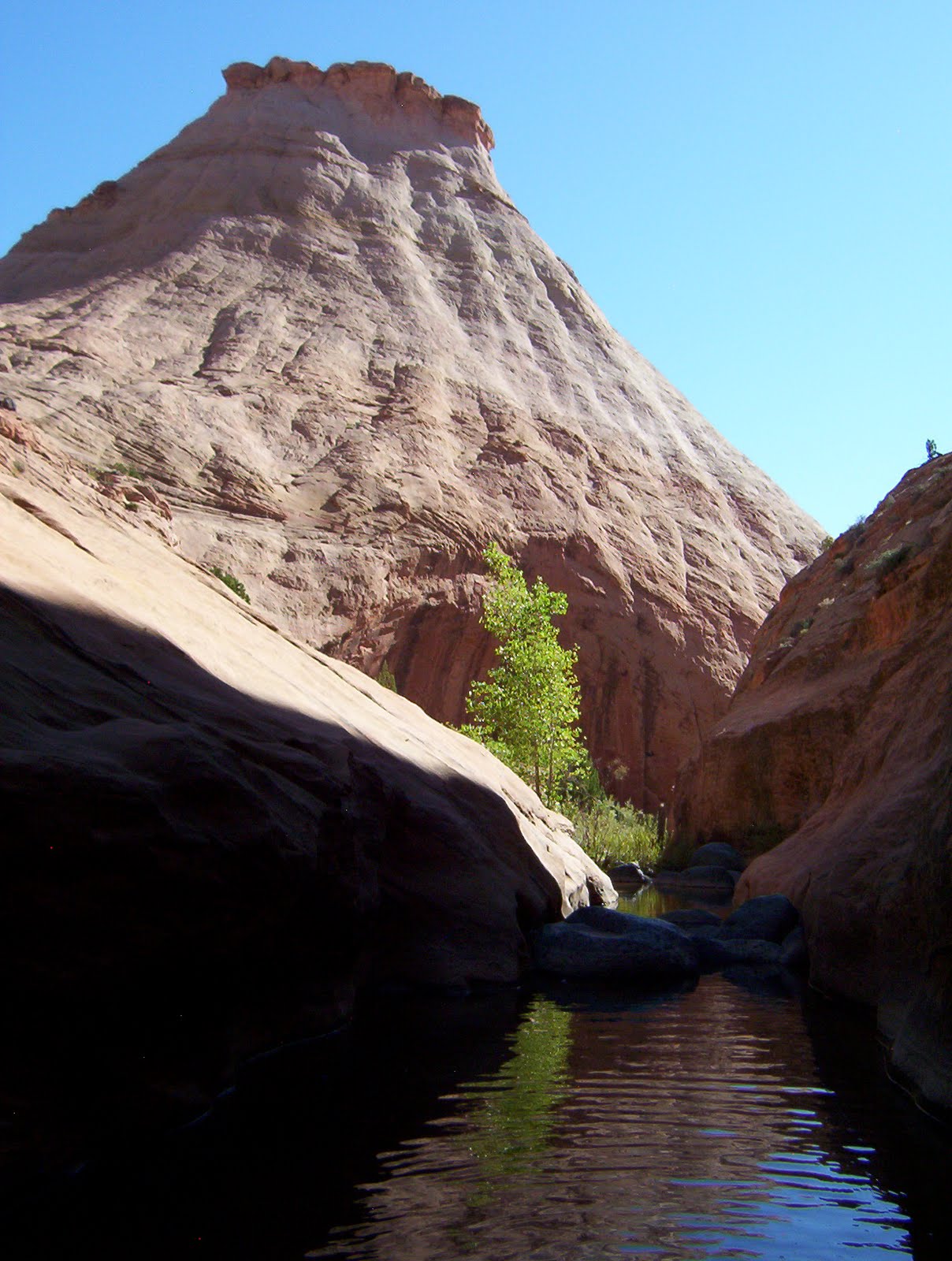
The first day of hiking then, ends up feeling like a gift. After leaving the still familiar concourse of the Mill Creek/Great Western Trail, we cross an unmaintained historic trail and find ourselves in a valley that feels empty. Stepping out from a dense copse of aspen caught in the middle of transforming from Summer to Fall, green to gold, a meadow of tall wheat colored grasses spreads out before us. It feels as though this basin hasn’t seen action since the pioneers built a mill here in the 1870s. Its gently rising sides are covered in aspens to the east and conifers to the west. The bowl shaped valley is easily over a mile and a half long and half a mile across, rising gradually in elevation to meet the back wall; a ridge that we will follow to re-intersect the Great Western. The trail we are following is visible, but only just; probably kept open by bow hunters. The amount of open space here feels luxurious. We see no foot prints in the dirt.


We descend to Desolation Lake—and the start of the Desolation Trail—in near darkness. In this subdued light, aspen trunks appear as simple lines. After a fat dinner of mashed potatoes, gravy, green beans from the farmers’ market, and backpacker steak (pre-cooked beef meatballs that were packed in frozen and allowed to thaw as we hiked), we snuggle down to spend a night burning off all those calories trying to keep warm. I sleep fabulously, better than I did in my own bed last night. I listen. No one is here but us.


Day 2: Trail Runners, Adam’s Ass and Other Curiosities

Trail runners are a breed I am almost entirely unfamiliar with. Their habits, customs of dress, all make no sense to me. Waking up in total darkness to the sound of pounding feet, I lie for a while listening, watching through the nylon of my tent as little headlamp lights bounce past. Then the singing starts, “Oh…oh,oh,oh…oh…mnamnamna…yah, yaaaahhh…ohohoh” all the way down, 200 vertical feet from ridge top to lake shore. It’s sometime before 6 am. That means these people have been running since at least 5:30. They left the warmth of their beds, put on their silly little shorts, and are running through a pristine, utterly silent landscape in the dark, listening to their ipods. These people are crazy.

Then there is a lull. By the time the 8 am crowd rolls through, Adam and I are sitting up in our tent eating bagels and cream cheese. A throng of at least 13 hikers joins the fray, making me glad that our camp is tucked behind a rocky outcropping. They laugh and tease each other, talking loudly, seeming to forget that here they don’t have to fight to be heard. Several more trail runners pass. Then a crowd of cyclists. After the last group, it grows quiet again and I crawl out of my tent to really look around. As I do, the sun comes up over the ridge to the east and illuminates the aspen stand surrounding us. The sky is so blue it stings. The leaves are suffused with bright yellow light. All around me the trees and the sky and the bushes are full with such an intensity of color; you couldn’t possibly inject anymore into them. Fruits ready to burst with juice. I of course, start to cry. I am a champion crier.

During the mid-morning lull, the one before all of the families with small children and Friday night partiers descend on Dog Lake (our next destination), we pack up. Just as we do, our quiet is cut through by the hack hack of a private helicopter tour out to see the colors. Incensed, Adam responds to this violent disruption of our first peaceful moment since waking in classic Adam fashion: he presents them with his bare backside. He dances around our camp, bare ass bobbing, taunting our areal tourists and singing a slanderous song, apparently for his own gratification since they obviously can’t hear him. The offenders respond by circling our camp one more time.

Before taking off for what will be a 7 mile day following the Desolation trail to Mill A Basin, we wander around Desolation Lake for a while. There is no record of how Desolation Lake, Desolation Peak, and other numerous Desolations scattered around Utah got their names. I don’t know, but I’m going to assume it’s biblical. The abomination of desolation and all that. The land of desolation, etc…. I can imagine that to pioneers coming from the much more lush east coast, and perhaps from the greens of Scotland, England and Ireland, this area did look pretty desolate. I do know that this lake is one of the few in the Wasatch that Mormon settlers, the CCC and the Forest Service haven’t messed with. Most of the rest—Lake Blanche, Lake Mary, the Twin Lakes—have been either created from basically nothing or amplified through damming. The lake is also a sump; a body of water with no outlet. It sits here, high up in this glacial bowl, an aquamarine jewel, set in an utterly bare red shore studded by a few sharp edged, black boulders. Since the area is watershed, swimming is strictly forbidden. If it were 10 degrees warmer, I would have to do it anyway. My standing as an otherwise law abiding citizen is safe another day.

Our trail takes us past Dog Lake—named by settlers in 1870 for the salamanders (or dog fish) swimming in its thick, murky, totally unappealing, depths and not, surprisingly, for the dozen odd dogs that seem to be a permanent fixture here—along the Millcreek/Big Cottonwood ridge until we enter the Mt Olympus Wilderness Area and quiet. Late in the afternoon, hotter than we thought we would be and consequently more thirsty, we approach Mill A Basin located just below Baker Pass. Since most hikers leave the Desolation trail here to climb Gobblers Knob, we hope to camp just a little further along, at the base of Mt Raymond. Turning the corner that brings our potential camp into view, we see a pillar of smoke. Below it, a bright orange tent blazes against a dark green juniper. Damn.

At this point I am a little dehydrated because it has been a while since we pumped water and I’m running low. In my exhaustion, I couldn’t care less where we camp and I’m having a hard time making a decision on a new place. Mill A doesn’t have any significant water, but Adam came across a spring here once while exploring the area a few years ago—a pipe coming right out of the hillside—and is hoping to find it again. After wandering a bit, we come across a historic trail, now abandoned, follow it into a hanging meadow and collapse in a field primarily inhabited by ground squirrels; every few steps our feet sink down into the dirt, caving in one of their innumerable tunnels.

As soon as we clear a big enough space on the ground for our tent, Adam heads off looking for the spring. Thirty minutes later he’s back. He can’t find it. He’s tired. It’s time to take stock. We have enough water to get through the night if we just eat sandwiches for dinner (instead of cooking the dehydrated beans, chicken, avocadoes, etc we had originally planned on), but in the morning we will need water right away. We have a few options. Adam could go looking for the spring again. He could hike up to Baker spring—1.4 miles and some serious elevation gain out of our way—fill up, then come back and meet me here so that we can continue along the Desolation Trail. Or we can both hike to Baker Spring, abandon our plans to hike the Deso Trail, and descend Alexander Basin, leaving us with a few miles of road hiking before we reach the car. We play a half game of cribbage and go to bed.

Day 3: Water

In the morning, we’ve just decided to hike to Baker Spring, ditching our original goal, when Adam sees a curiously inscripted aspen just south of our camp. He wanders off. I barely pay attention until he comes back carrying 3 litre bottles of water with Sam’s Club labels neatly intact. “There’s a cache over there,” he motions. I follow him to the aspen, the treasure map; “Buz 2004” and an arrow pointing south. Just behind a good sized log, a slightly molded and chewed up tarp covers a pit with 4 bottles of water and a metal grate wrapped in cellophane. Adam seems lighter. His relief is obvious. I worry, what about Buz? What if he comes back assuming his water is here? Adam shrugs, “If Buz is even in the state any more, I’d be surprised.” He’s right. It’s been 6 years. Buz probably hopped a train to California ages ago. Leaving with our water bladders at least a little more full, I pause and say a little prayer of thanks to Buz.


The next section of trail is the one that when planning the trip, I was most anxious to see. It’s the section that I knew I would never make it to on a day hike. Even though it’s the furthest west we’ve been, and therefore the closest to the city, it’s the most remote, the least accessed. We leave Mill A for Maxfield Basin, at least not really a basin from where we are so much as a steeply graded, nearly all sluffed off, excuse for a trail, dropping into a basin hundreds of feet below. As I traverse the massively eroded hill side, my pack throwing my balance off, holding my breath at the airyness of the trail, I reach for bushes to stabilize myself only to find too late that they are thorny rose bushes. I only have to panic for a minute. After 50 yards or so, the hillside turns, gentles, the trail widens, though not by much.


The trail for the rest of the day remains patchy, overgrown here and there, frequently passing across shale rock slides. We circumambulate Mount Raymond, following the Desolation to the top of Porter Fork where we leave Big Cottonwood and return to Millcreek. This is where I run out of water. It’s lunch time. We still have over 3 miles to the next water source but most of the remaining trail is north facing and down hill. We don’t worry.

Our descent is littered with the remains of mines, historic trails, cabin debris. As we continue down Porter, Adam points out a claim site where he once found an old cabin, unlocked and entirely intact. It was still thoroughly outfitted, shelves of burlap bags, wool blankets and tin canisters. Adam opened several: canisters and canisters of oatmeal. The mine has since been collapsed by the Forest Service and the cabin is gone, whether by avalanche or man power we don’t know.

It’s still about 2 miles to water when I start to feel the effects of dehydration. I’ve been slurping off Adam’s water but I haven’t wanted to be greedy. It’s much hotter than we anticipated. I get irritable and clumsy. The trail sucks. I have mesh vents in my hiking shoes that are supposed to keep my feet cool but all they’re doing is letting in dirt and sticks which in turn are giving me blisters. It’s 1 more mile to water when we run out.

When planning the trip, Adam suggested that we leave the Desolation trail for the last few miles in favor of descending Thayne Canyon instead. Thayne’s is prettier, taking it would cut 3 miles from what would otherwise be a 10 mile day, and there is supposed to be a spring just below the trail junction where he had watered up before. I decide not to be a purist and take his suggestion. Just after the Thayne/Desolation junction, Adam starts looking around for the spring. It, like the Mill A spring has a pipe coming right out of the ground. When we reach it, it’s high noon and at least 85 degrees. The trough where the spring is supposed to be is shallow and muddy. The pipe lies uselessly on the ground next to the grimy skim of water. There isn’t enough water to submerge our pump into. Adam starts trying to clean out the trough, hoping it will speed the flow and raise the water level. It’s no good. At first he panics and runs up and down the canyon, looking for some other little place where water might surface. There isn’t one. We resignedly shoulder our packs—the only up side to having no water is lighter packs—and quietly head down. It’s been 3 miles since I had a real drink. It’s a couple more to the truck.


The trail down Thayne Canyon cuts through the hill side in a steep sided, rock strewn trough. The walls are covered in red maple and orange and yellow ground cover. The trail is littered with gold aspen leaves. I barely notice. Adam keeps taking off up moist looking spur trails, looking for water. Nothing. My blisters are so bad now, I’m limping badly. When we get within a half mile of the trail head, we encounter our first hikers. I must look as good as I feel because I am getting some stares.

When we get to the truck, Adam remembers that he doesn’t have any water there either, unusual for him, so we have to drive up canyon, through the insane traffic of Sunday afternoon picnicers, a wedding party walking precariously up the road in heels, and what is apparently a family reunion in order to find a quiet place to pump. I’m feeling the strangest sensation; where we have been all day is so different from all of this, it feels like a dream, and all of this is so familiar, it feels like we never went anywhere.

Our original plan was to finish hiking and head to the Cotton Bottom Inn, a bar and grill located at the top of 6200S. Open since at least the 60s, it’s nothing like anything you could possibly imagine finding in this otherwise hoity toity neighborhood. The Porcupine Grill, with its 12$ nachos, doesn’t hold a candle to it for food or ambience. You enter through the kitchen, ducking to avoid low doorways, and come into a wood paneled, loungy, cozy, laid back room of battered mismatched furniture. Bugs bunny is everywhere in one form or another. Most people there are regulars, pool players, and motorcyclists. In the summertime and early fall, the back porch is open, busy and a raging party. They serve fries and grilled ham and cheese and all kinds of stuff but, all anyone goes there for are the garlic burgers. Seriously. These garlic burgers are the definition of garlic burgers, the be all end all, reason to come down the canyon, who cares if you smell bad for a week, fabulisiousist garlic burgers ever. But I am tired. And I don’t want to hang out anywhere but my couch. And my cat is lonely and feeling betrayed, I can feel her intense self-pity, hear her plaintive yowls, from here. So I decide to cheat. In twenty-five minutes I am on my couch, Este pizza on my lap. Trifecta will have to wait for another trip.


A little bit of useful information…

Region: Central/North-Central Utah

Contact Info:
Cotton Bottom Inn
2820 E 6200 S
Holladay, UT 84121
(801) 273-9830

Rating (out of 5) ☼☼☼☼☼:

Burger ☼☼☼☼☼ Fries ☼☼☼ Shake N/A

You May Want to Visit the Cotton Bottom if you are:
Climbing in Little/Big Cottonwood
Camping at the Spruces, Redman, or Albion Basin camp grounds
Skiing or snowboarding in Big/Little Cottonwood
Paragliding off Point of the Mountain or above Ferguson canyon
Bow hunting up Bear Trap canyon
Bird watching in the Wasatch
On a moon light, star gazing, hike away from all the city lights
Escaping inversion
Visiting your ostentatious mountain home…ie your cabin…up the canyon
Searching for faint trails you found in the Rambler (Wasatch Mountain Club)
Hiking the Desolation Trail!


Wednesday, September 15, 2010

Antimony Mercantile: Antimony

Despite the fact that the calendar has just flipped over to September, it is, as Adam says, still very much Summer. We are in the desert. It is Labor day weekend. It’s evening, around 5:30 or so, and it’s still at least 80 degrees. We have just dropped off the east side of Highway 12’s hogback; a narrow, windy, slip of road riding the steep-sided ridge between Calf Creek to the west and Boulder Creek to the east. Although I have traveled this stretch of road literally a hundred times, driving this tiny wedge suspended between dramatic drop-offs still leaves my adrenals stressed and my palms sweaty.


We are tromping across sandy hills covered still, thankfully, joyfully in Sand Verbena (a good name, we think, for a dog), Spiderwort (a flower, not some sort of horrible growth), filmy white patches of Primrose, and Sunflowers. Soon, the sand spreads out across slick rock washes, stone looking as though the water that formed it were still running in rivulets across its surface. The ground is nearly white, occasionally stained gold, rust, or rose. The wash we are following heads down and down, connects with another wash, runs off to the side a little, meanders and then drops off into Boulder Creek.

We move slowly. I am still getting over a three week respiratory infection that had me in bed and then in bed and then in bed a little more. I haven’t carried a pack in a while and I feel laborious and clumsy. Adam skims on ahead of me, sauntering down the slick rock, his walking stick clicking occasionally against juniper roots and sandstone. Adam moves easily, he fairly glides down the steep descent we make to the creek. I have to walk looking at my feet so as not to tumble down the wash. I stop occasionally so that I can look around and remember where I am. I will never move as gracefully through the desert as Adam.


The country around us rises in domes, mesas and turrets, castle battlements made of whitish-gold sandstone. Thirty minutes later we get to the creek bottom, hot, a little irritable and happy for shady Cottonwood trees. This section of Boulder Creek is still relatively close to town—more so than our usual adventure destinations—as evidenced by down-canyon-debris. We pass a big old oil drum, some graffiti etched into the sandstone declaring that “Emily is the Shit,” and a scrunched up green metal gate washed down by a flash flood. It’s obvious that a flash flood of some magnitude tore through here pretty recently. All of the ground cover, water loving willows and tamarisk lay flat, pointing haggardly down stream. It makes walking down canyon alternately a total pain-in-the-ass-thrash and an easy stroll since you can actually see where you are going rather than having to battle through thickets of willows, looking for a trail. Flood debris—bunches of leaves and dirt and bird feathers—rides high in the tops of any tamarisk still standing. A waterline, like a grimy bathtub ring runs close to the canyon walls over even the highest banks. Finding high ground in this flood would have been nearly impossible.


Even as we thrash, Adam and I look at each other every few minutes with wide grins. It’s a thrash and a pain but we are in the desert! It’s been nearly two months since our last trip and the last few weeks have seen us stopping every so often to stare out the window and sigh, longing vocally for a wet canyon and some Cottonwood trees. And here we finally are. As I thrash and trip and stroll, I bring the world down to sounds and smell.
There is very little sound. The pitch of the water riffling down creek shifts slightly depending on whether it’s passing over pebbles, sand, slime, or smooth rock. I can’t hear any birds. I don’t even hear bugs. The air smells awesome. Clean and green and a little mulchy from the flood dregs and that smell particular to rock eroding away under the force of water whether rain or sprinklers or river.

Because we are still relatively high in elevation, we pass the occasional towering Ponderosa; some, burnt out carcasses, lightning struck. Signs of people become more faint. We hike nearly three miles and even though we are headed further down stream tomorrow, decide to camp at what is an exit trail, forming a loop hike that could take you back to the trail head, up on the hogback of Highway 12. This trail too, follows a wash. We scamper up a short wall to a little ridge overlooking the smooth sandy wash bottom. The sand is spotless, not even a bird track. The sky is clear with no forecasted rain. We plop our stuff down right in the middle of the sand and lie out. Our packs are ridiculously heavy for a three—not even full—day trip. This is largely due to the mass quantity of food we brought with us. We are not scrimpers when it comes to food, Adam and I. Adam is a beanpole and we both have blood sugar issues so we need an almost constant stream of calories when hiking. Nuts and other usual backpacking fare won’t cut it however so our food bags are filled with turkey, hard boiled eggs, fresh cucumber from the farmers market, bell pepper...tonight we hover over our cook pot chopping cilantro and green onion to throw into the Pad Thai we are making. A few years ago after I took my whole (almost) family backpacking for the first time, my dad asked my 13 and 15 year old brothers what they had liked best about the trip. They uniformly agreed that the food, not the soaring red walls of Coyote Gulch, not the impressively sized Steven’s Arch, not the pictographs and Anasazi ruins, had made their trip. Nope, it was the miso-ginger-chicken soup I had made the first night out. I guess I’m flattered, but almost anything tastes good when you’re backpacking.


When we lie down to sleep, the crickets are really getting going, pulsing rhythmically into the night. Just above our heads are a series of potholes with slightly stagnant murk crusting over the top. After a few games of Mille Bourne, we turn our headlamps off to flee the gnats and mosquitoes. A few minutes later, without the mesmeric drawing power of the light, the bugs recede and we settle in to a peacefully star-lit night.


The next day we proceed down canyon, stopping at the first real show of entrenched narrows for second breakfast. The canyon is filled with willows and rose bushes that tear at our legs and drive us to criss-cross the stream again and again looking for a clear path. Then, hurray! a smooth rocky sidewalk rises up out of the creek for a stretch, making for delightfully cruisey walking. Just around the corner from where Deer Creek intersects Boulder, we find our exit point and settle in for a lazy and utterly quiet afternoon.

I read. Adam naps and takes short walks up and down the creek, closely examining a patch of thick green moss, some bug larvae, fish hiding beneath the stream banks. I find a deep enough section of creek just below our hangout to take a dip. I watch for birds and look around at the gold walls. I eat a little and wander around barefoot. Adam eats a little and sleeps some more. The afternoon passes. We don’t see another person all day. Just before sundown we hike out, back up onto the golden-white citadels and boulder-strewn mesas above. At the base of the steep pass we need to mount the next day we make camp and look out at the view. Across the creek stretches a slick rock play ground called the Brigham Tea Bench. Between the domes and scalloped tops of the bench lay little green valleys filled with gold flowers and pinion pine. We sit, lean back on our packs and watch the day slowly disappear.


The next morning we are hiking by 6, trying to beat the heat of the sun and get back to the truck by 10. The walk is a constant delight as this is country I have never seen except from the distance of the road and the isolation of my car. Flowers decorate our path, surprising us at every turn. Once back at the truck, we decide to make our way home as slowly as possible, relishing our vacation to the last minute and take the long way to our next destination: The Antimony Mercantile. Stopping briefly at the visitor’s center in Escalante—which is strangely deserted of tourists on what should otherwise be a rowdy weekend—we take off up Main Canyon and over Boulder Mountain. We drive slowly, smelling the Ponderosa scented air and looking at the remains of past forest fires, musing about our time working on the mountain for the Forest Service. As we climb, we pass the corner in the road where I cut through my first really huge tree with an ax. We pass several trail heads we both meant to explore during our seasons on the trail crew. We slow down at Adam’s favorite look-out spot and take in the view: the Straight Cliffs from head to the toe, the entire Circle Cliffs uplift, the Henries, and Mancos Mesa all the way over by Lake Powell.

The Dixie Forest, of which Boulder Mountain is part, is not a grand or dramatic range. But it is gently lovely, littered with any number of meadows—filled now with flowers—and hundreds of little lakes and ponds. Sweet relief when the desert proves too steamy. Coming up over the crest, we run into a cavalcade of ATVs, headed off on a hunting trip. The more volcanic parts of the mountain blend on this side with dramatically red outcroppings that reach full expression further south in Bryce Canyon. Every time we stop to look at a good crumbly hoodoo, peeking up from an otherwise green hillside, a truck full of hunters stops to look, hoping we’ve spotted a buck.

The Main Canyon road we are taking is also sometimes called the Widtsoe road, even though Widtsoe is barely a destination. With 1,100 residents in the late 20’s, the town was once considered as a location for the county seat. Mostly a ghost town now, the township hosts a few mobile homes and one original log cabin. The last time I visited Antimony Merc (17 miles north), there was a man at the bar who told me the classic pioneer tale of growing up in that cabin with his 13 brothers and sisters. He had to be at least 90. We pass Widtsoe as we leave the mountains, entering John’s Valley. Both the names “John” and “Widtsoe” come from John Widtsoe, the president of the University of Utah in 1917, whose expertise in dry farming helped farmers in the area eek out an existence for nearly two decades before finally moving south to the San Juan.

Intersecting Highway 22, we head north and soon drop into Black Canyon, an intimate little gorge with a marshy creek running along the bottom. At times the walls of the canyon loom up grey and bold right next to your car, then spread out eroding into steep rubbely hills cresting hundreds of feet above. The land above is flat as flat. The canyon bottom feels like a hidden world.

In Black Canyon, 12 miles north of Widstoe is another ghost town; Osiris. Well, not really a ghost town as there was only ever one house there—still there and hidden up in the trees—and the remains of an old creamery, perched on the edge of the creek. Every time I pass the creamery, I badly want to explore it. The creamery was built in the twenties, turned into a granary, and abandoned in the 30’s due to drought. The main building is tall and narrow and not at all forbidding considering its isolated location and age. The windows are open and free from glass, making it all the more tempting to crawl right over the sorry-little-fence surrounding the premises, mount the rickety stairs, taking them right to the top.

By the time we reach Antimony we are starving. Antimony is a sort of story book town. The main street is tree lined, enormous old cottonwoods and poplars. Alfalfa fields roll off the road and down into a valley cut through by a number of creeks. Clearly happy cows loll and laze. The few—nearly all historic—houses in town are set back from the road, surrounded by more trees. There is, unfortunately, an abomination of a dude ranch with a huge, plastic, rearing white stallion on the roof of the guest house. And then there is the Antimony Mercantile.


The Antimony Mercantile is a combination grocery store, bait &tackle shop, diner, gas station (with old fashioned pumps), R.V. park and one of my favorite places on earth. It’s not enough that they make their own pie, fresh every day and that their burgers are the definition of slutty goodness, it is the whole package that I love. Inside, the ceiling is low and the shop is jam packed full of stuff. All kinds of stuff. The grill has a bar running long side it and around the corner is the little indoor eating area. The walls surrounding the tables are full, I mean every inch full of pictures of locals with their freshly caught fish, freshly shot elk, slung over the back of their ATVs. There are a few little cubby shelves stuffed with cheap, used paperbacks that you can take, if you leave one in return. There are a few chotchkys, mostly fishing related. Then there is the porch, the best place to sit.

The back porch is littered with picnic tables and metal tables surrounded by mismatched chairs. The roof is made from rough hewn logs and decked with ceiling fans, indoor faux-wood ceiling fans, looking like they’ve been taken from some old dear’s bedroom. There are a few plastic cacti hanging on the wooden back wall of the porch and two outdoor restrooms with “Doe” and “Buck” written on the doors. Next to the porch is a little horse shoe lot, where two guys are playing horse shoes. There is a Jeep parked dangerously close to the end of the lot and each time the men turn to throw that direction, I cringe in disastrous anticipation. The whole back R.V lot is surrounded by tall cottonwoods so that the porch is always shady and cool, even when it’s broiling out.

All summer old folks set up their RV’s, go fishin’ all morning, then spend the afternoon chatting on the porch, drinking coffee and coke from the bottle, and smoking cigarettes. These people now live in Florida but come back here to be with their grandkids and ride ATVs around the mountain. They all know each other. Have for decades. We sit at an old picnic table. Next to us are two couples in their seventies. The men wear impossibly baggy Lee jeans held up by rainbow striped suspenders. The women have on layers of fusia lipstick and hairsprayed hair. One has a little nondescript white dog on her lap which she talks to in baby talk, calling it “baby” and referring to her self as “momma” as she feeds it little bits of burger. The other woman moans pornographically over her burger, exclaiming “oh my!” and “this is soooo good!” through mouthfuls of food. The family to the other side, the one playing hose shoes, jokes and laughs and compares the effectiveness of ATVs as hunting vehicles, “The problem with the new Polaris is that it doesn’t have any room! You can put an extra gas can on the back, but where you supposed to put your deer once you kill it?!” None of these people are in a hurry. The wind rustles the trees every once in a while. The whole scene is slow and soothing.

When our quick moving, fast talking, locals chatting, cowboyboot wearing waitress brings our food, Adam and I don’t even talk to each other as we eat, we’re so hungry. I of course, order the Antimony Burger. I always order the Antimony Burger but have not, until today, ever been able to finish it. It is a ½ a pound of meat, gooood tasty meat not that soy bean crap, topped with lettuce, tomato, onion, melted cheddar cheese, mushrooms (from the can, but who cares) sautéed with more onions and bacon. Thick, peppery wonderful bacon. I don’t know what they do, I think I can taste garlic salt, but this burger is amazing. I can’t stop smiling as I eat. I am sold. They, as far as burgers go, win.
We move on to cherry pie with ice cream and homemade cinnamon rolls, drizzled with frosting. We smelled them when we first came in, an hour ago now, and get the last one. The pie crust is home made, flaky and thin. The cherries are from a can. It’s still good. When we are finished eating, we linger, stuffed and happy. The breeze moves around us. We look around and listen. We grin at each other.


A little bit of useful info…

Region: South Central, Utah

Contact Info:
(435) 624-3253 70 N Highway 22, Antimony, UT 84712


Rating (out of 5) ☼☼☼☼☼:

Burger ☼☼☼☼☼ Fries ☼☼ Shake N/A

You may want to visit the Antimony Mercantile if you are…

* Fishing at Otter Creek and/or Otter Creek Reservoir
* Camping up Antimony Creek
* Riding ATVs around on Boulder Mountain or up Antimony Creek
* Fishing or hunting on Boulder Mountain
* Driving an RV around the South West
* Driving an RV around to all the National Parks
* Climbing at “the Jungle” on the Aquarius Plateau (Boulder Mountain)
* Driving home from Escalante and environs
* Visiting Bryce Canyon National Park
* Touring Utah’s ghost towns—see: The Historical Guide to Utah Ghost Towns by Stephen Carr. * You can find this at Sam Wellers and Ken Sanders in SLC
* Hiking or horse back riding the Great Western Trail
* Eating your way home from somewhere great!